Nike Missile Site D-69 IFC, River Rouge Park Michigan
Longitude: -83.2479626799933
This location was part of the Detroit Defense Area
Site ID: D-69
This site controlled the missiles at the Launch Area located here.
Site Role: IFC
A typical Nike air defense site consisted of two separate parcels of land. One area was known as the Integrated Fire Control (IFC) Area. This site contained the Nike system's ground-based radar and computer systems designed to detect and track hostile aircraft, and to guide the missiles to their targets.
The second parcel of land was known as the Launcher Area. At the launcher area, Nike missiles were stored horizontally within heavily constructed underground missile magazines. A large, missile elevator brought the Nikes to the surface of the site where they would be pushed across twin steel rails to one of four satellite launchers.
Elaboration on how Nike worked here.
Missile Type: Ajax
The Nike Ajax was the first in the Army's family of guided missiles, and the world's first operational, guided, surface-to-air missile system. Nike Ajax had a burnout speed of Mach 2.3, a range of 25-30 miles, and a ceiling of 65,000 feet.
Designed to carry either nuclear and/or high-explosive warheads, the Nike Hercules missile could attack supersonic aircraft operating at altitudes in excess of 150,000 feet and at a range of more than 87 miles.
Battery Type: single

Once a week, according to Rouge Park's local history, Detroit residents gathered along Outer Drive to watch missiles rise from the ground and then disappear again. The spectacle looked public, but the purpose was deadly serious. Nike D-69 was a short-lived, first-generation air-defense battery built inside one of Detroit's largest parks to help stop Soviet bombers before they reached the factories, transportation corridors, and neighborhoods of the metropolitan region. The Army leased parkland in 1954, placed the Ajax battery in operation during the mid-1950s, transferred it to the Michigan Army National Guard in 1959, and closed it in February 1963. Crews and sensitive equipment moved on. Radar towers came down. The underground magazines were stripped, deliberately cracked for drainage, filled, and graded. The launch tract ultimately became part of Rouge Park's prairie and recreation landscape.
D-69 is often remembered inaccurately as a nuclear missile base with three silos. The official record says otherwise. It was an Ajax-only site with two B-type underground magazines, twenty Ajax missiles in the designed configuration, and eight Ajax launchers. Nike Ajax carried a conventional warhead. The vertical underground spaces were missile-storage magazines with elevators, not strategic-missile silos. Those distinctions matter because they change both the scale of the installation and the risk it represented.
One military building did survive the 1963 restoration, but it was not part of the operational Integrated Fire Control compound. It was the former mess hall in D-69's separate cantonment area north of Joy Road. The City of Detroit reused it for decades as the Parks and Recreation Department's West District Headquarters. The Friends of Rouge Park later met there. That afterlife makes D-69 unusually tangible even though the launcher and radar site themselves were erased.
Location and Site Identity
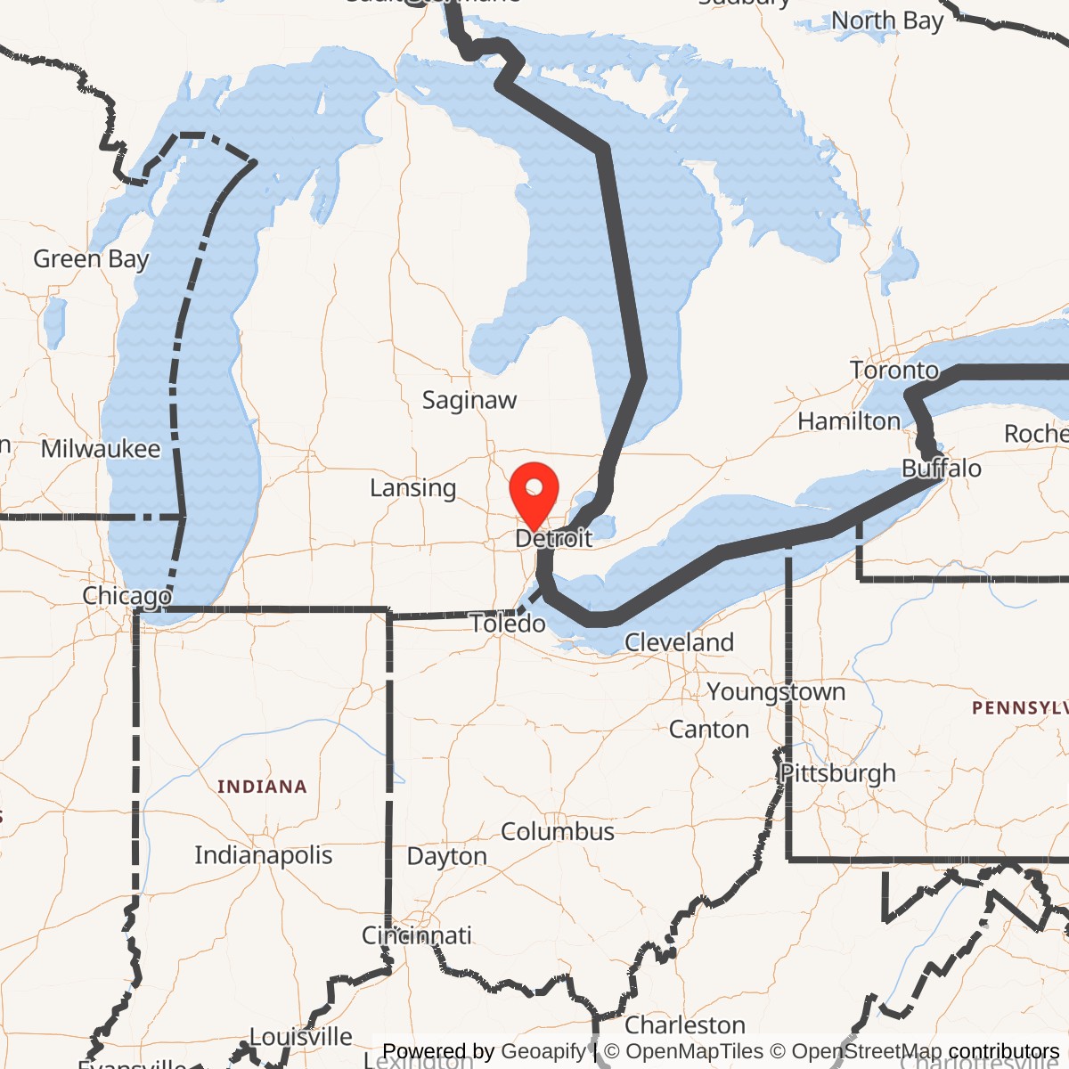
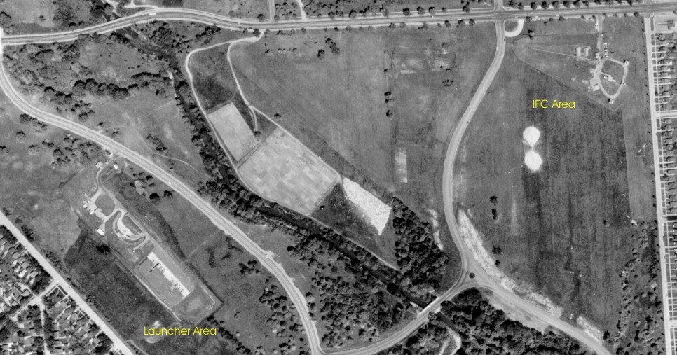
Nike D-69 stood in Rouge Park on Detroit's far west side, in Wayne County, Michigan. The official national inventory calls the location River Rouge Park. That name has been repeated in federal property records and later missile-site lists, but it is geographically misleading. The site was not in the separate downriver municipality of River Rouge. It was in Detroit's Rouge Park.The installation occupied several leased tracts serving three functional areas. The Integrated Fire Control area was south of Joy Road between Trinity Street and Spinoza Drive, near the park's eastern edge. The launcher was west of Outer Drive and south of Joy Road, within the open park ground that later became associated with the Rouge Park Prairie and Butterfly Garden. The cantonment and administration area, including the orderly room, supply room, barracks, and mess hall, was north of Joy Road near Spinoza Drive.
The IFC and launcher were operationally inseparable but physically separated. Radar operators and engagement controllers at the IFC acquired and tracked a target, tracked the missile, and used an analog computer to calculate the intercept. Launcher crews maintained the missiles, elevators, surface rails, and firing positions. Communications circuits transmitted commands and status between the two areas. The cantonment supported the people who kept both operational components functioning.
Rouge Park Before Nike
The missile battery did not introduce the military to an untouched landscape. Detroit established Rouge Park in 1925. The present City of Detroit page describes it as Michigan's largest urban park, a broad landscape centered on the Rouge River and containing recreation grounds, woods, prairie, and wetlands.During the Second World War, Camp River Rouge Park operated north of Joy Road between Lahser Road and Spinoza Drive. The local park history describes a recreation camp with tents for five hundred soldiers on leave and barracks for another five hundred members of the 728th Military Police Battalion. The park's recreation center was reserved for service members during the war. This earlier military use has its own Formerly Used Defense Sites identity, CAMP RIVER ROUGE PK, E05MI0017. It should not be confused with Nike D-69's later RIVER ROUGE PARK property, E05MI0126.
That distinction matters because the same public park held military facilities in two different eras. The wartime camp served soldiers during a global conflict. The Nike battery was a fixed Cold War weapon system. Some roads, utilities, developed clearings, or institutional familiarity with Army use may have made the park attractive for the later project, but no reviewed record proves that D-69 simply reused specific wartime buildings. The safest interpretation is continuity at the landscape level, not an undocumented one-for-one conversion of Camp River Rouge Park into the missile battery.
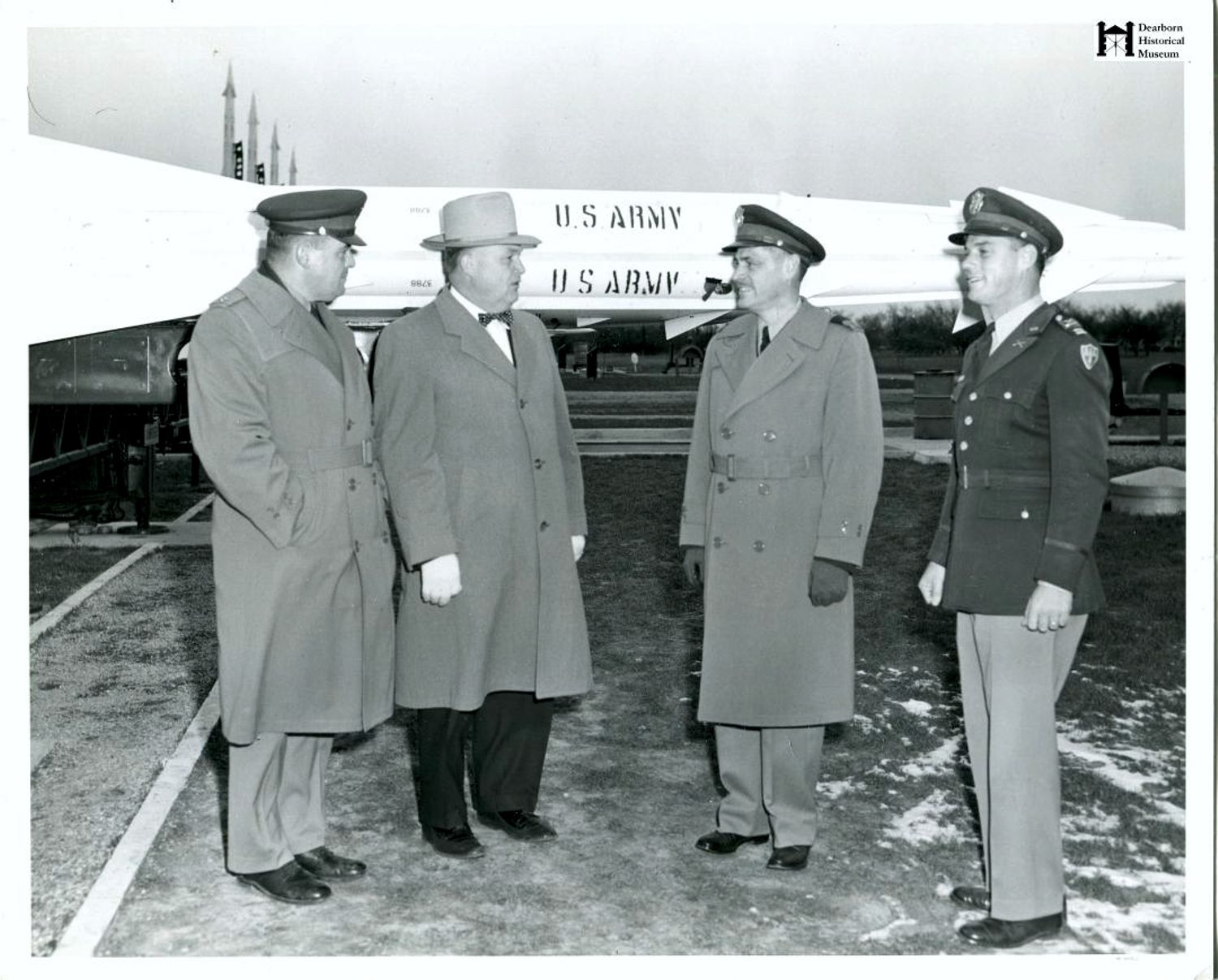
The park setting also shaped public memory. D-69 was not hidden on a remote military reservation. Its gates opened from city streets. Families used nearby park facilities. Traffic passed on Joy Road and Outer Drive. A period photograph shows Dearborn mayor Orville Hubbard visiting the launcher in the late 1950s, and the local history remembers spectators watching missile-raising drills. The installation was restricted, but its physical presence was woven into ordinary civic space.
Lease, Construction, and the Problem of the Opening Date
The Formerly Used Defense Sites property description reproduced on the dedicated D-69 history records that Department of Defense use began on February 15, 1954, when the Army leased 70.56 acres from the City of Detroit. The lease covered six tracts used for cantonment, control, and launcher purposes. This is the earliest precise D-69 date located in the present pass.Land acquisition was not the same thing as an operational battery. Surveying, design, grading, utility installation, magazine excavation, concrete work, radar erection, equipment acceptance, crew training, missile issue, and readiness certification followed on different schedules. The dedicated D-69 site chronology gives January 1955 as activation, and the 2025 local history likewise says the military built the base in 1955. The official national inventory instead lists active service from 1956 through February 1963.
These dates do not have to describe the same milestone. February 1954 is the lease and federal-use date. January 1955 is the best site-specific activation date found. The official 1956 date may represent formal operational acceptance, a rounded inventory year, or a different readiness threshold. Without a battery journal, acceptance certificate, or unit order, the exact transition from construction site to combat-ready battery remains unresolved.
Physical Layout
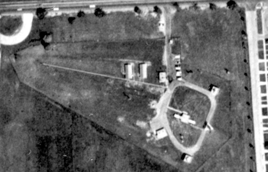
D-69 followed the standard separated Nike Ajax pattern, but the park setting spread its functions across multiple leased tracts. The IFC occupied a fenced parcel south of Joy Road. A veteran of the Guard battery remembered its entrance between Trinity and Spinoza, with a guard shack, ready room, and corridor building. He placed the acquisition radar east of the operating vans, the missile-tracking radar to the southeast, and the target-tracking radar to the southwest. His distances are recollections rather than surveyed dimensions, but they describe the functional geometry of an Ajax IFC.The IFC's LOPAR, or Low-Power Acquisition Radar, searched for aircraft and supplied target information. Once a target was assigned, the target-tracking radar followed it while the missile-tracking radar followed the departing Ajax. An analog computer continuously compared the two tracks, predicted an intercept, and generated steering commands. The system then transmitted guidance orders to the missile and, at the calculated point, the burst command.
The veteran described a corridor building aligned east to west and linked to the radar-control equipment. He also remembered a ready room with bunks, a duty-officer space, a latrine, and an oil stove. These details make clear that the IFC was both a technical plant and a place where crews lived through alert shifts. Radar scopes and electronic cabinets depended on guard duty, heating, generators, maintenance, food, and sleep.
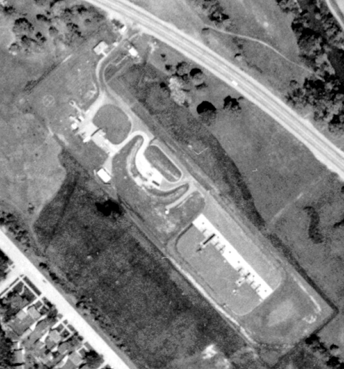
The launcher stood farther southwest along Outer Drive. Its two underground B-type magazines stored missiles horizontally. Elevators raised missiles to the surface, where crews moved them along rails to eight launcher positions. The site also needed assembly and test space, a fueling and neutralization area for Ajax's hazardous liquid sustainer propellants, generators, ready facilities, security fencing, and circulation for missile-handling equipment.
Local memory often calls the underground structures silos. That word suggests a vertical strategic missile held ready for launch from the same shaft. D-69 instead used horizontal magazines. Several missiles could be stored underground in a section, raised on a common elevator, and transferred to surface launchers. The distinction is not pedantic. It explains why the Army later removed elevator pistons, cracked walls and slabs, filled the underground spaces, and regraded the ground rather than extracting self-contained vertical launch tubes.
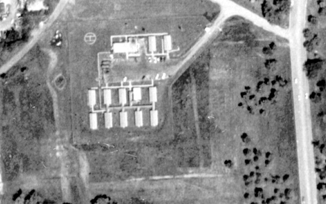
The cantonment lay north of Joy Road. The veteran remembered an orderly room, supply room, mess hall, and barracks off Spinoza Drive. A 1961 aerial caption also identifies an administration area and a marked helicopter landing area. Of these support facilities, the former mess hall became the most durable part of D-69's physical legacy.
Configuration and Decoded Meaning
The official configuration is: Nike 2B/20A/8L-AThe `2B` portion means two B-type underground missile-storage magazines. In the official Nike key, a B magazine could support Ajax and could be modified for Hercules-related elevator and launcher requirements. D-69 never received that conversion. At this site the two B magazines remained in Ajax service.
The `20A` portion records twenty Nike Ajax missiles in the configured allowance. It should not be read as a photographed count on every alert day. Missiles could be absent for maintenance, depot work, training, inspection, or final drawdown. It is a design and inventory figure, not a daily log.
The `8L-A` portion records eight Ajax launcher positions. They were surface launchers fed by the underground magazines. The code does not support the local claim that the base had three silos. Two underground magazines and eight surface launcher positions are the official site-specific figures.
D-69 was Ajax-only. The official Detroit overview lists the sites converted to Hercules between 1958 and 1961, and D-69 is not among them. The dedicated site page also identifies only Ajax missiles, Ajax launchers, and LOPAR.
Nike Ajax carried a conventional fragmentation warhead. It was not a nuclear missile. Nike Hercules, the larger successor, could carry either conventional or nuclear warheads, but D-69 did not operate Hercules. The 2025 local history's reference to nuclear missiles is therefore a system-level confusion, not evidence of nuclear weapons in Rouge Park. No site-specific nuclear storage, custody, or warhead record was located because the battery's documented weapon was not nuclear-capable.
Regular Army Operation
The dedicated D-69 unit chronology places Battery C, 504th Antiaircraft Artillery Missile Battalion at Rouge Park from January 1955 through June 1957. This assignment aligns with the site-specific January 1955 activation date.In June 1957, Battery A, 18th Antiaircraft Artillery Missile Battalion succeeded the 504th battery. In September 1958, another Army reorganization placed D-69 under Battery A, 4th Missile Battalion, 3rd Artillery. The changes in unit designation did not represent three different missile bases. They reflected the Army's evolving air-defense structure and the adoption of Combat Arms Regimental System designations.
During the Regular Army period, launcher crews managed a demanding liquid-fueled weapon. Ajax's sustainer propellants required protective clothing, careful fueling and neutralization procedures, testing, ventilation, and disciplined response to leaks. Crews inspected elevators, rails, launchers, cables, missile components, and generators. IFC personnel aligned and calibrated radar, checked analog-computer circuits, exercised communications, and practiced simulated engagements.
The battery's mission was readiness, not routine firing from Detroit. Live-fire proficiency took place at ranges. A later Guard veteran recalled traveling to McGregor Missile Range near Fort Bliss for training and firing. At Rouge Park, drills could include raising missiles to the surface, moving them into position, testing the engagement chain, and returning them underground. The local account of weekly drills watched from Outer Drive is plausible in that operational context, although it is a community recollection rather than an official training schedule.
The absence of a combat launch does not mean the site was inactive. D-69's value depended on a potential attacker believing that the system would function. The ordinary alert shift, with radar aligned, missiles serviceable, communications tested, and crews ready, was the work that sustained deterrence.
Michigan Army National Guard Transition
Battery B, 1st Missile Battalion, 177th Artillery, Michigan Army National Guard, took over D-69 in 1959 and operated it until closure. The dedicated chronology starts the Guard assignment in November 1959. A veteran participant remembered the future Guard command staff at the site in spring 1959, unit training at Fort Bliss beginning in April, and an official takeover after the unit returned in September. The two accounts differ by approximately two months. The most responsible reading is that training and transition unfolded through 1959, with the formal unit table placing the completed assignment in November.The veteran's recollection reveals what Guard operation meant. Personnel normally worked eight-hour shifts, with smaller evening and overnight coverage. During heightened alert, two teams alternated twenty-four-hour periods at the site. Crews traveled to Texas for live-fire and electronic-countermeasures training. These were not occasional ceremonial duties. Fixed air defense demanded continuous technical competence, security, maintenance, and alert staffing.
The 177th carried an important Michigan lineage. The Michigan Department of Military and Veterans Affairs traces the unit that became the 1279th Combat Engineer Battalion, the state's only all-African-American National Guard organization when first organized, through postwar redesignation as the integrated 227th Antiaircraft Artillery Battalion and ultimately to the 1st Missile Battalion, 177th Artillery. The official state history says that lineage ended with retirement of the 177th missile battalion in 1974.
That institutional lineage should not be turned into an unsupported claim that every D-69 soldier had served in the earlier engineer battalion. It does show that the Guard organization operating Rouge Park connected the Nike mission to a distinguished Detroit and Michigan military tradition that extended through wartime engineering, antiaircraft artillery, and guided missiles.
Life at a Missile Site in a City Park
D-69's park location made secrecy relative. The radar function, technical details, alert state, and weapons procedures were controlled information. The towers, fences, gates, elevators, and drills were visible facts. Children, motorists, park users, and municipal employees encountered the installation as part of the neighborhood landscape.The local history remembers crowds on Outer Drive watching missiles rise and descend during weekly drills. The surviving photograph of Mayor Hubbard at the launcher shows formal civic access as well. Such visibility did not mean the public could enter freely. Guards, fencing, restricted areas, and controlled tours separated observation from access.
For the soldiers, the site was a workplace that never fully slept. Radar and launcher status had to be monitored across evenings, weekends, and winter weather. Snow, ice, mud, temperature changes, and power interruptions affected equipment and roads. Ajax demanded careful handling of fuels and oxidizers. The IFC's electronics generated heat and required calibration. Personnel ate in the mess hall, slept in ready spaces, stood guard, maintained records, and waited through long periods when nothing dramatic happened.
The cantonment made those routines possible. Its later civic reuse is easy to understand because a mess hall already had utilities, road access, substantial construction, and adaptable interior space. The radar towers and missile magazines were specialized military structures. The support building could become an office.
Role in the Wider Military Network
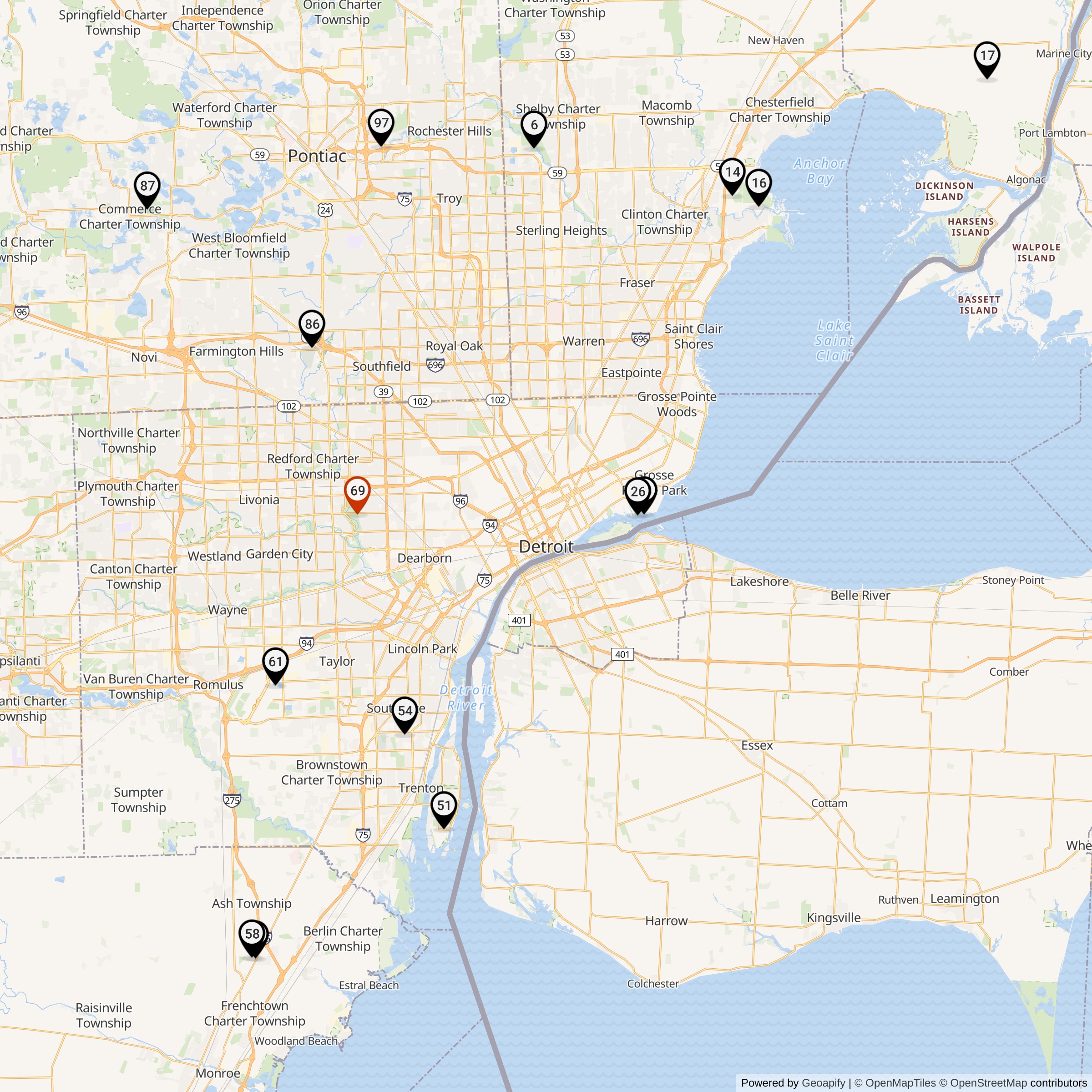
D-69 occupied the western side of the Detroit Defense Area. Nearby batteries included D-61 at Wayne County Airport to the southwest, D-54/55 and D-51 in the downriver sector, D-26 near Fort Wayne, D-28 near Detroit City Airport, and the northern and eastern sites that completed the metropolitan ring. Their coverage overlapped so that the loss or engagement limits of one battery would not automatically open an undefended corridor.The defended asset was not a single factory or neighborhood. Detroit's automobile plants, steel and chemical works, river traffic, rail yards, airports, power systems, military installations, and dense population formed a target complex of national importance. Rouge Park placed D-69 near the western approaches and within reach of the urban-industrial area it helped protect.
Higher-level coordination came from the Army Air Defense Command Post at Selfridge. The Detroit system used Missile Master and later Missile Mentor to assemble wider radar information and assign targets among batteries. Those command systems did not fly an individual D-69 missile from Selfridge. Once an engagement was assigned, the local IFC still had to track the target and missile, solve the intercept, transmit steering commands, and order detonation.
D-69's Ajax-only status placed it in the first generation of that network. Hercules sites could reach farther, higher, and faster, allowing the Army to reduce the number of batteries while maintaining broader coverage. Between 1958 and 1961, Detroit sites D-06, D-16, D-26, D-58, D-61, and D-87 converted to Hercules. D-69 did not. Its closure in 1963 belonged to the nationwide phaseout of Ajax and consolidation around fewer Hercules batteries.
Why D-69 Closed
Several pieces of evidence illuminate the 1963 closure, but no reviewed decision memorandum reduces it to one cause. Nationally, the Army was eliminating Ajax-only batteries as Hercules coverage matured. Locally, the Friends of Rouge Park history says the Army sought a fifty-year lease in 1962 to continue and expand the base and that the Parks and Recreation Department rejected the request. A Guard veteran remembered that his unit went to El Paso for Hercules training in fall 1962 and then took over the Hercules battery at D-61, Detroit Metro Airport.Together, these sources describe a plausible transition. D-69's personnel could move into the surviving Hercules network while the City recovered parkland that it did not want to lease for another half century. The evidence does not establish whether lease rejection, force-structure change, system obsolescence, or a combination was the formal controlling reason.
D-69 deactivated in February 1963. The dedicated unit table and official national inventory agree on that month. The FUDS property description records partial restoration beginning April 23, 1963, and termination of the 70.56-acre lease on June 30, 1963. Those later dates mark cleanup and real-estate turnover, not continued missile alert.
Restoration and Return to the City
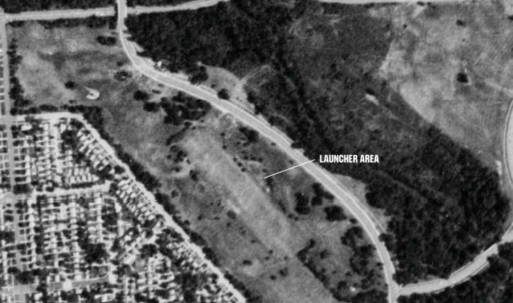
The 1963 restoration was substantial. The FUDS description says masonry-block buildings, radar towers, and underground storage tanks were removed from the control area. At the launcher, the Army removed equipment from the underground magazines, including the elevator pistons. Workers cracked magazine walls and slabs to permit drainage, filled the spaces with clay or other natural material, and regraded the surface.This process explains why no operational launcher survived even if buried concrete remains. The magazines were not merely locked and abandoned. They were deliberately disabled and incorporated into the park landscape. The 1988 aerial reportedly showed tonal or terrain differences where the launcher had stood, but no standing launch equipment.
The government and city did not require every improvement to be demolished. On a 3.55-acre tract, the Army transferred underground sanitary sewers, water lines, communication and electrical lines, utility services, the mess hall, and an adjacent underground storage tank. The city then used the former mess hall as the Parks and Recreation Department's West District Headquarters.
The distinction between restoration areas is critical. The operational IFC was removed. The launch area was stripped, fractured, filled, and graded. A support building in the cantonment survived through an explicit property-transfer decision. Calling the IFC simply partially intact hides that more precise history.
School, Recreation, and Prairie Reuse
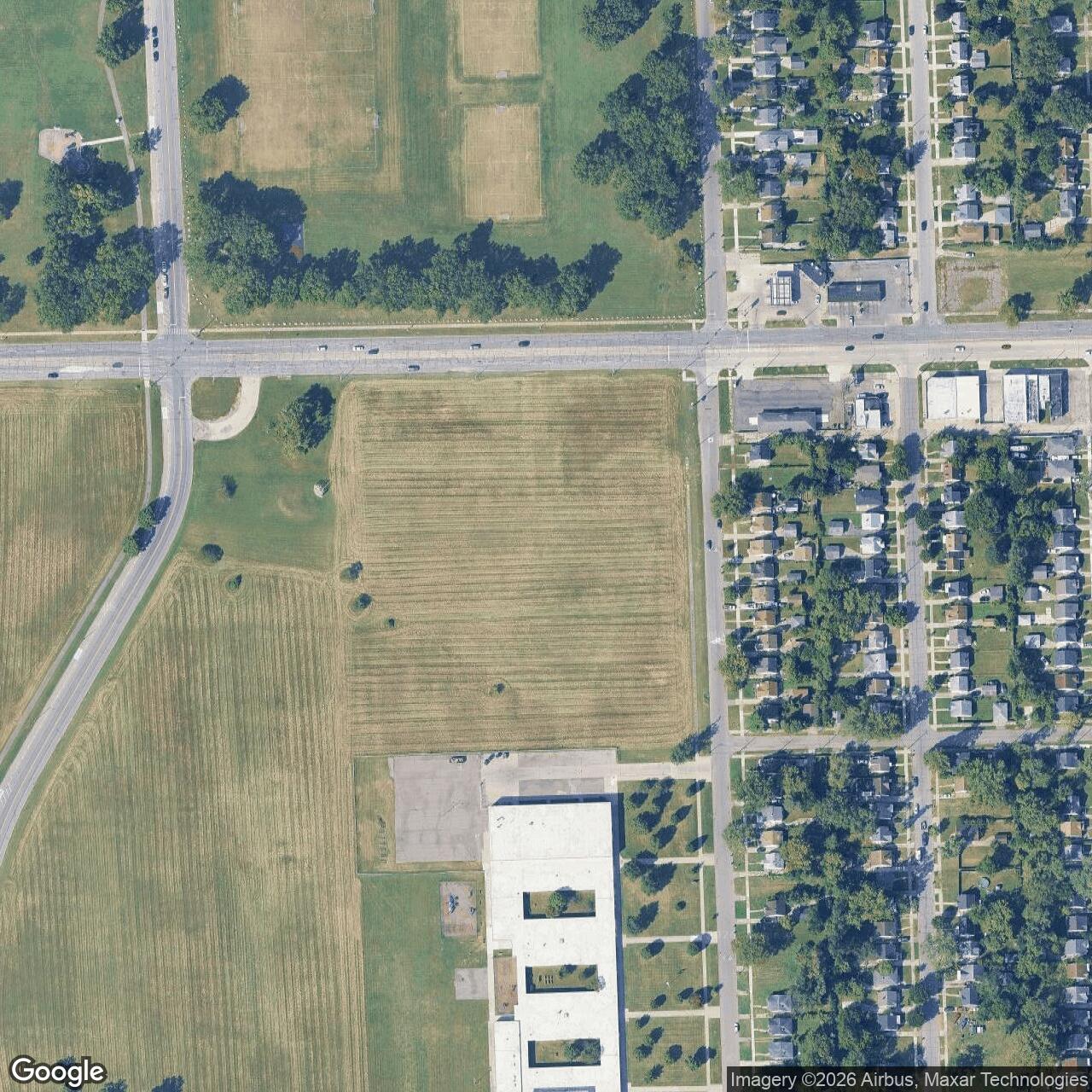
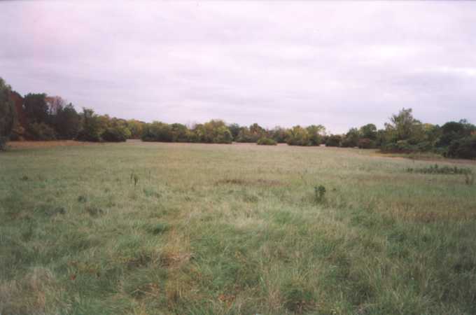
The land returned quickly to civic use. The local park history says twenty acres were taken for Lessenger Junior High School construction in 1964 and that softball fields were added. Site history places the former IFC just north of what is now the school property. The exact boundaries of the school conveyance and the former federal tracts require a parcel overlay, so the school should be treated as an adjacent successor landscape rather than casually placed atop every part of the IFC.The former launch area became park ground. The FUDS account describes a general play area and ice-skating pond. Later local interpretation associates the Rouge Park Prairie and Butterfly Garden with the former Nike base. Friends of Rouge Park says prairie restoration began in 2000 and the Prairie Pathway opened in 2010. The present City of Detroit page describes sixty acres of native prairie in Rouge Park and an active prairie-restoration effort.
This is one of the more complete transformations in the Detroit defense ring. A landscape engineered for liquid-fueled missiles, concrete magazines, elevators, rails, and fences now supports native grasses, wildflowers, pollinators, trails, and public recreation. The military geometry is no longer obvious at ground level, but the continuity of open space makes the site easier to understand than a former launcher buried beneath dense commercial development.
The park continues to change. Detroit is preparing a new long-range Rouge Park master plan, and the city's current page reports a 2026 public-planning process. A separate Detroit Water and Sewerage Department project has constructed stormwater infrastructure in the broader park while explicitly directing designers to respect the Butterfly Garden and Prairie Trail. Those current projects should not be attributed automatically to the former missile magazines without engineering overlays, but they show that the D-69 landscape remains active public infrastructure rather than frozen memorial ground.
Formerly Used Defense Sites Record
The federal property identity for the Nike installation is RIVER ROUGE PARK, E05MI0126. The 2001 General Accounting Office inventory listed it as eligible for the Formerly Used Defense Sites cleanup program, with hazards present, two eligible projects, $198,000 in recorded cost to date, and an estimated $278,000 cost to complete at that time. A companion project table identified one container or hazardous-and-toxic-waste project and one hazardous-and-toxic-waste project in remedial phases.These are historical program snapshots, not a current environmental clearance or a finding that every part of Rouge Park remains contaminated. Likewise, the presence of an associated underground storage tank at the former mess hall and removed tanks at the IFC does not establish present conditions without later investigation records.
The Nike property must also be separated from CAMP RIVER ROUGE PK, E05MI0017. The same 2001 inventory listed that earlier wartime property independently, with its own projects and costs. Researchers who search only by park name can easily combine the two military episodes and mis-assign environmental work, buildings, or dates.
Current Component Conditions
The former D-69 IFC is not partially intact as an operational Nike control site. Its radar towers and masonry buildings were removed during the 1963 restoration. The tract is city park and school-edge landscape south of Joy Road between Trinity and Spinoza. No reviewed current survey identifies a surviving radar pad, control building, ready room, tower foundation, or generator structure above ground. Subsurface utilities or foundations may remain, but they have not been verified for public interpretation.The former launcher is obliterated at the surface. Its magazines were emptied, their concrete walls and slabs cracked, the voids filled, and the area regraded. Later recreational, prairie, garden, trail, and possibly drainage uses occupy the broader landscape. Filled underground concrete may persist, but there are no intact elevators, pistons, launch rails, or usable magazines.
The former mess hall survives in the cantonment area north of Joy Road. The FUDS account documents its transfer to the city and reuse as the West District Headquarters. The Friends of Rouge Park says the office closed in the early 2000s, that the organization held some of its earliest meetings there, and that renovation for General Services Department offices was underway as of its July 2025 history post.
The entire D-69 property remains associated with the City of Detroit. Operational components are gone, but the cantonment building, altered subsurface launcher fabric, road relationships, aerial evidence, and documentary record preserve different layers of the site.
Responsible Research and Visiting
Unlike Nike sites inside active airports or private industrial compounds, much of the D-69 landscape is public parkland. Visitors may use open Rouge Park roads, trails, gardens, and recreation areas during posted hours and under ordinary park rules. Public access does not authorize entry into closed buildings, fenced work areas, school property, utility sites, or construction zones.
Chronology
- 1925 Detroit establishes Rouge Park. The current city page describes it as Michigan's largest urban park.
- World War II Camp River Rouge Park operates north of Joy Road with recreation tents and barracks for military personnel. This earlier use later receives the separate FUDS property number E05MI0017.
- February 15, 1954 The Army begins Department of Defense use of 70.56 acres leased from the City of Detroit for Nike D-69 cantonment, control, and launcher areas.
- 1954-1955 Construction, equipment installation, crew preparation, and acceptance occur through multiple milestones.
- January 1955 The dedicated D-69 chronology gives this as activation. Battery C, 504th Antiaircraft Artillery Missile Battalion begins the recorded unit sequence.
- 1956 The official national inventory gives this as D-69's opening year. The difference from the 1955 site-specific date remains unresolved.
- June 1957 Battery A, 18th Antiaircraft Artillery Missile Battalion succeeds the 504th battery.
- September 1958 Battery A, 4th Missile Battalion, 3rd Artillery assumes the Regular Army designation at D-69.
- Spring-fall 1959 Michigan Army National Guard personnel organize and train for the D-69 mission. A veteran remembers Fort Bliss training beginning in April and takeover after a September return.
- November 1959 The dedicated unit table begins Battery B, 1st Missile Battalion, 177th Artillery, Michigan Army National Guard service at D-69.
- 1961 Aerial images document the complete D-69 complex, including launcher, IFC, and administration area.
- 1962 The local park history says the Army asks for a fifty-year lease to continue and expand the base and that Parks and Recreation rejects the request. No reviewed decision file establishes the exact terms or its weight in the closure decision.
- Fall 1962 A Guard veteran recalls D-69 personnel training on Hercules at Fort Bliss and later transferring to D-61 at Detroit Metro Airport.
- February 1963 D-69 deactivates. The official national inventory and dedicated unit chronology agree on the month.
- April 23, 1963 The FUDS property description records the start of partial federal restoration.
- June 30, 1963 The Army terminates the 70.56-acre lease. The IFC is demolished; the launch magazines are stripped, cracked, filled, and graded. Selected cantonment improvements, including the mess hall and utilities on a 3.55-acre tract, transfer to the city.
- 1964 Local park history says twenty acres are taken for Lessenger Junior High School and softball fields are added in the returned landscape.
- June 6, 1988 A later aerial image documents the former launcher tract after removal and park reuse.
- 2000 Friends of Rouge Park dates the beginning of prairie restoration in the former-base landscape to this year.
- 2001 The GAO FUDS inventory lists RIVER ROUGE PARK, E05MI0126, with hazards and two eligible projects. It separately lists CAMP RIVER ROUGE PK, E05MI0017.
- Early 2000s According to the local park history, the former mess hall's use as the West District office ends.
- 2010 The Prairie Pathway opens after years of ecological restoration.
- July 2025 Friends of Rouge Park publishes a new local history of the Nike base and reports renovation of the former West District office for General Services use.
- 2025-2026 The City of Detroit develops a new Rouge Park master plan and continues prairie restoration and other park projects.
- Present The IFC and launcher have no verified aboveground Nike structures. The former cantonment mess hall survives. The broader launch landscape functions as public park, prairie, garden, trail, and recreation ground.
List of all Nike Installations in Michigan
Sources & References
- PDF Defend and Deter: The Legacy of the United States Cold War Missile Program Primary official synthesis for the Detroit Defense Area
- WEB Friends of Rouge Park, The Nike Missile Base: 1955-1963, published July 9, 2025 Local source for the remembered public drills, 1962 lease request, 1963 return to park use.
- WEB Friends of Rouge Park, History Local source for Camp River Rouge Park during the Second World War
- WEB Friends of Rouge Park, Prairie Pathway Source for prairie restoration beginning in 2000.
- WEB City of Detroit, Rouge Park Current official source for park ownership and character, the 2025-2026 master-planning process, sixty-acre prairie, and current prairie-restoration work.
- WEB City of Detroit Water and Sewerage Department Current official source for infrastructure work in the broader park and the design commitment
- WEB Michigan Department of Military and Veterans Affairs, 1279th Combat Engineers Official state source for the lineage from Michigan's all-African-American 1279th Combat Engineer Battalion through the integrated 227th Antiaircraft Artillery Battalion to the 1st Missile Battalion, 177th Artillery.
- WEB U.S. General Accounting Office, Michigan Properties Identified for Potential Inclusion in FUDS Cleanup Program, 2001.
- WEB U.S. General Accounting Office, Michigan FUDS project table, 2001 Official historical project-status snapshot for the two RIVER ROUGE PARK projects.
- WEB National Archives at Chicago, Nike Missile Sites finding aid Archival locator for Detroit District standard drawings.
- WEB Ed Thelen, Michigan Nike location compilation Secondary cross-check for D-69's placement in Detroit's Rouge Park, component descriptions, and older observations.