
Naval Outlying Landing Field Heath - Sky Sailing Airport, Fremont California
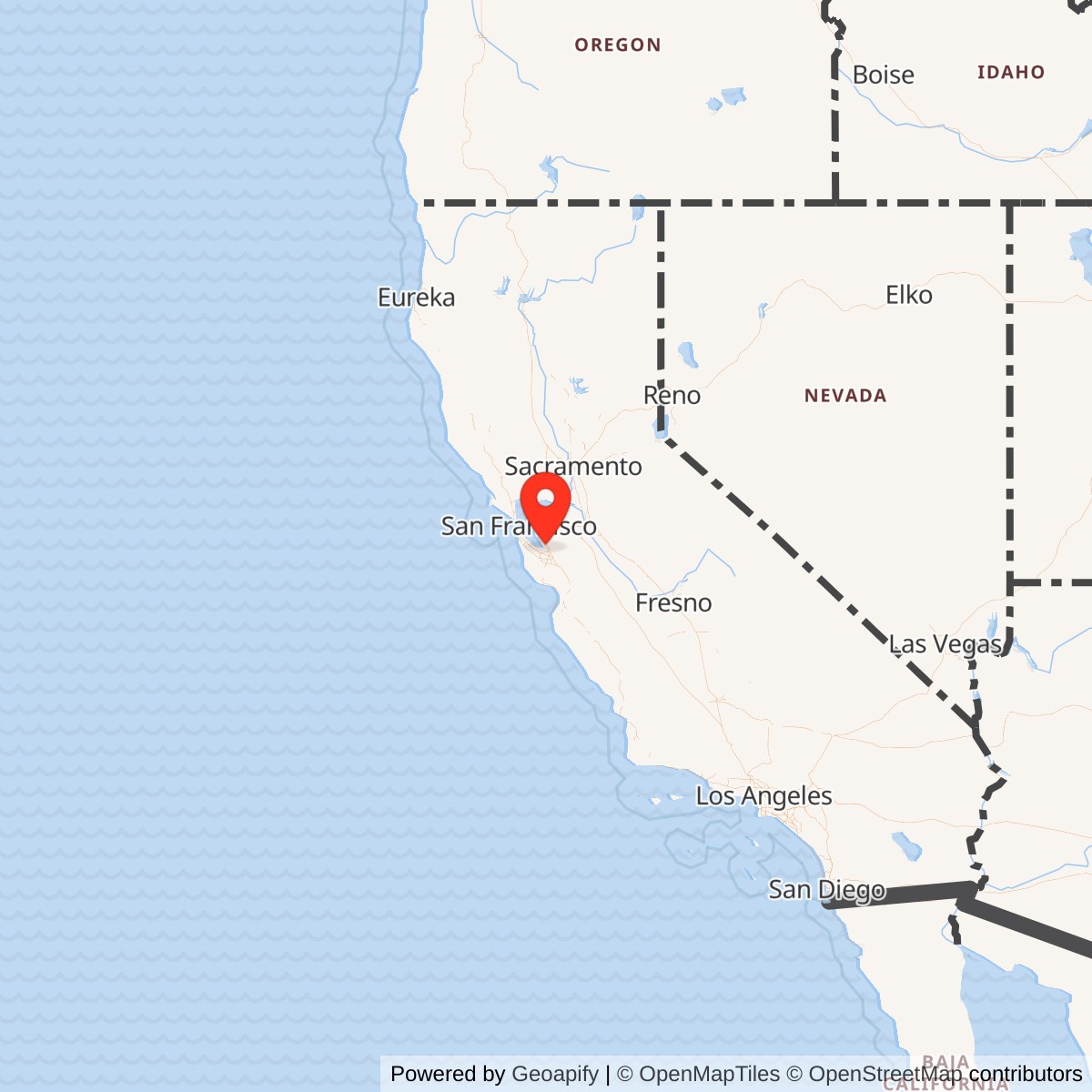
Longitude: -121.96
Current Role: Former NAS Livermore outlying landing field on leased Heath family land; documented in the 1944 Army/Navy Directory-derived listing as NOLF Heath with a 3,100-foot runway at 37.5, -121.96; later associated with Skyways/Sky Sailing Airport, Fremont Dragstrip, I-880, and commercial redevelopment; no active Navy or airport use.
Naval Outlying Landing Field Heath, also associated in later references with the names Coelho, Skyways Airport, and Sky Sailing Airport, was one of the temporary satellite landing fields that made Naval Air Station Livermore work as a World War II aviation-training system. It was not a full naval air station, and the available public record does not show a large independent command, permanent barracks district, hangar line, ammunition area, or long postwar Navy career. Its military identity was narrower and more practical: it was a leased outlying landing field where Navy student pilots could practice the repeated takeoffs, approaches, landings, and local flying that could not all be handled safely at the parent station.
The field was located in the Warm Springs / Fremont area of Alameda County, east of San Francisco Bay and southwest of NAS Livermore. Airfield-history research identifies the site as the original Warm Springs Airport location before its Navy use, then as NOLF Heath, and later as Skyways Airport and Sky Sailing Airport. The Navy apparently leased a square 160-acre tract from the Heath family in 1942 or early 1943. In Navy documentation described by airfield-history researchers, the field was initially designated Field "H" and carried Bureau of Aeronautics number 22817.
The Livermore outlying-field source trail also associates the site with Coelho. The same source corpus identifies a later civilian airport history at or near the site, including Skyways Airport, Sky Sailing Airport, and the adjacent Fremont Dragstrip. Because the Navy field was temporary, because its land was reused quickly, and because later civilian flying activity occupied nearby ground, the safest interpretation is to treat Heath / Coelho as one former Navy outlying-field identity with a later civilian-airport and dragstrip afterlife.
Heath belonged to the NAS Livermore network, not to the active Air Force or Army installation lists. Its reason for existence was the wartime Navy pilot pipeline. Naval aviation in the Bay Area needed more training surfaces than the major stations could provide. Heath supplied one of those surfaces.
Mission and Military Role
Heath's mission was to support flight training by giving Navy instructors and students another landing surface outside the main traffic pattern at NAS Livermore. During the early war, naval aviation training expanded at extraordinary speed. Every new pilot needed repeated landing practice before advancing through the training pipeline. Large stations such as Oakland and Livermore handled administration, maintenance, housing, and command. Outlying fields such as Heath handled the repetitive flying work that consumed runway time.That mission made Heath more important than its small footprint suggests. The basic landing pattern is where student pilots learned judgment, approach control, crosswind correction, go-around discipline, traffic awareness, and confidence. If every student aircraft had to perform that work at the main station, congestion and accident risk increased. Outlying fields dispersed traffic and allowed multiple groups to train at the same time. Heath was one of the pressure valves that kept the Livermore training system from becoming overloaded.
The 1944 U.S. Army and Navy Directory of Airfields, as preserved in airfield-history research, described NOLF Heath as one of the outlying landing fields assigned to NAS Livermore and listed a 3,100-foot runway. The source's broader discussion also describes Heath as a Navy auxiliary airfield depicted on the August 1944 San Francisco Sectional Chart. That 3,100-foot runway placed Heath in the middle range of the Livermore satellite fields, longer than Gelderman's 2,200-foot sod strip but shorter than Brown-Fabian's 6,300-foot sod runway.
The field's early administrative connection is especially interesting. Airfield-history research reports that Heath was leased to support flight training at NAS Oakland before being tied into the NAS Livermore system. That fits the broader Bay Area transition. Oakland's Navy aviation facilities were crowded, and Livermore became the inland primary-training station. Heath's placement between the South Bay, East Bay, and Livermore training geography made it useful during that transition.
An August 1943 episode shows how valuable even a small OLF could be. NAS Moffett Field staff reportedly requested Heath and Abel for possible airship landing-procedure training, partly because of congestion at Moffett Field. NAS Livermore resisted, saying it could not operate effectively without those fields. Whether or not Heath was ever used for blimp operations, the incident shows that outlying fields were contested resources within the wartime Navy training system. Heath was not simply spare rural ground. It was capacity.
Site Design and Facilities
The available record points to a very simple installation. Heath was a 160-acre leased field with a 3,100-foot runway. The sources found do not document a permanent control tower, hangars, barracks, independent headquarters, large fuel farm, hospital, magazines, or maintenance complex. That absence is consistent with its outlying-field function. The field's purpose was the landing area itself.The earliest located depiction was a 1943 diagram showing the field as a square outline. The August 1944 San Francisco Sectional Chart depicted it as a Navy auxiliary airfield. Later aerial and map evidence, as summarized by airfield-history researchers, suggests that the Navy field had little permanent construction. A 1946 aerial view reportedly showed the former Heath NOLF as an open grass field without hangars or other improvements, and later USGS maps from 1953 and 1955 did not depict an airfield at the location.
Heath therefore fits the temporary OLF pattern. The Navy could lease open land, mark or prepare a landing surface, connect the site to the parent station's schedule, use it during the training emergency, and then release it with little permanent infrastructure left behind. The field was not built to become a permanent post. It was built or adapted to absorb wartime training pressure.
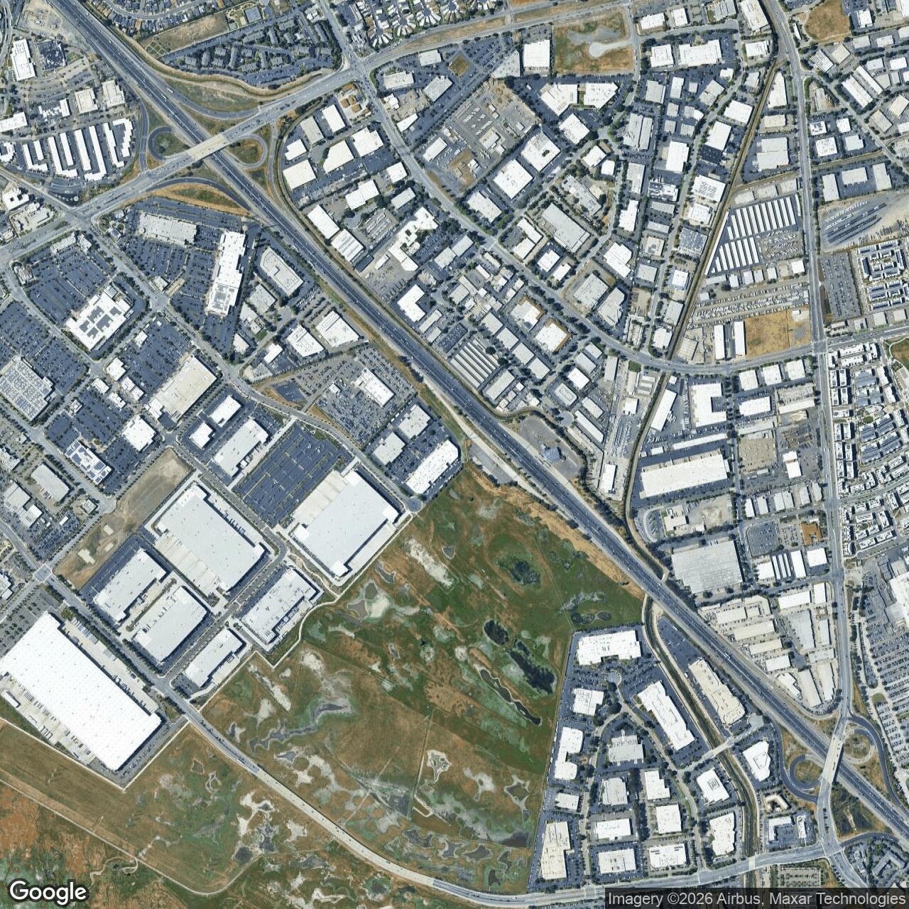
The postwar physical story became more complicated. The freeway later cut through or near the former NOLF area, and the Fremont Dragstrip was built along the northern edge of the former Navy-field property. Civilian glider and light-aircraft activity followed in the late 1950s and early 1960s, when Sky Sailing Airport developed near the dragstrip. The later civilian runway was described as an oiled-gravel strip, initially about 1,800 feet with roughly 3,000 feet from fence to fence, and aeronautical charts in 1961 depicted Sky Sailing Airport with a 2,300-foot unpaved runway.
Those later uses should not be confused with a continuous Navy aviation mission. They do show that the open, flat qualities that made Heath attractive to the Navy also made the landscape suitable for civilian flying and motorsports after the war. By the late twentieth century the airport and dragstrip had disappeared into transportation and commercial redevelopment. The field's physical trace today is difficult to read without historic maps and aerial imagery.
Role in the Wider Military Network
Heath's importance comes from its place in a distributed naval aviation network. NAS Livermore was the parent station, but Livermore could not do its job using only the main airfield. Its surrounding outlying fields spread flight training across the wider East Bay and San Joaquin Valley edge. That network included Abel, Brown, Brown-Fabian, Cope, Gelderman, Heath, Lindeman, the older Livermore field, Mays School, Rita-Butterworth, Spring Valley, and Wagoner.The Navy's World War II California activities list identifies Naval Air Station Livermore, Wagoner Field, and a Combat Aircrew Refresher Training Unit at Livermore. The directory-derived airfield list supplies the more granular outlying-field layer. Together they show that Livermore functioned as a system rather than a single point. Heath was one of the pieces that allowed that system to handle flight-training volume.
Heath also reveals how flexible the Navy's wartime land-use strategy could be. Instead of building every training facility from scratch as a permanent base, the Navy used leases, local fields, rural property, and temporary improvements. That made it possible to expand quickly and to match training capacity to wartime demand. Once the demand fell, those fields could be closed with far less institutional consequence than a major station.
The 1943 Moffett-Livermore tension over Heath and Abel is especially useful because it shows that satellite fields had network value beyond their immediate parent station. Moffett's lighter-than-air program wanted congestion relief. Livermore needed the same fields for fixed-wing primary training. Heath sat inside that shared Bay Area training environment, where multiple commands needed flying space and had to negotiate the use of limited safe landing areas.
Strategically, Heath did not launch combat operations from California. It helped train the pilots who moved through the pipeline toward operational units. That makes its role indirect but essential. Naval air power in the Pacific depended on major carriers, aircraft factories, repair depots, and combat squadrons. It also depended on thousands of ordinary practice landings at temporary fields like Heath.
Postwar Reuse and Current Status
Navy use of Heath appears to have ended quickly. Airfield-history research states that NOLF Heath was evidently abandoned at some point between 1944 and 1945, because it no longer appeared on the March 1945 San Francisco Sectional Chart. No long-term postwar Navy mission has been identified for the site.After the war, the landscape around the former Navy field shifted into civilian and transportation uses. Later civilian airport activity emerged under the Skyways and Sky Sailing names, with glider training becoming a notable part of the site's memory. Sky Sailing Airport appeared on the March 1961 San Francisco Sectional Chart, and the 1961 USGS map showed Sky Sailing Airport near the Fremont Raceways dragstrip. The field supported glider lessons, sailplane activity, and local civilian aviation rather than military operations.
The Fremont Dragstrip became another layer of the postwar site story. It operated along the northern edge of the former Navy-field property and gave the area a motorsports identity for decades. The construction of Interstate 880 and later commercial development altered the former aviation landscape further. Secondary airfield summaries state that the airport closed in June 1989 and that the site is now commercial property.
The current status is therefore closed former naval outlying landing field, no active Navy use, no active airport use, and later civilian-airport, dragstrip, freeway, and commercial redevelopment. The coordinates used here identify the documented airfield reference location, not a surveyed Navy lease boundary. If original Bureau of Aeronautics lease files, county property maps, or Navy station plans are later located, they may refine the exact boundary and the relationship between the wartime Heath field and the later Sky Sailing / Fremont Dragstrip property.
Chronology
- 1933 Warm Springs Airport appeared on the San Francisco Airway Map in the general area later associated with Heath / Skyways / Sky Sailing Airport.
- 1934 A Civil Aeronautics Administration bulletin described Warm Springs Airport as an auxiliary field with a rectangular adobe surface and a 1,500-foot north/south runway.
- 1939 Warm Springs Airport still appeared on the February 1939 San Francisco Sectional Chart.
- 1941 Warm Springs Airport was no longer depicted on sectional charts by the April 1941 period, indicating the earlier civil field had probably closed before Navy use.
- 1942 or early 1943 The Navy leased a square-shaped 160-acre tract from the Heath family for use as an outlying field supporting flight training operations, initially designated Field "H" and Bureau of Aeronautics number 22817.
- 1943 A Navy-related diagram depicted NOLF Heath as a square-shaped field outline.
- 1943-08 NAS Moffett Field staff requested Heath and Abel for possible airship landing-procedure training, but NAS Livermore resisted because it needed the fields to operate effectively.
- 1944 The August 1944 San Francisco Sectional Chart depicted Heath as a Navy auxiliary airfield.
- 1944 The 1944 U.S. Army and Navy Directory of Airfields, as preserved in airfield-history research, described NOLF Heath as a NAS Livermore outlying field with a 3,100-foot runway.
- 1944-10-15 NAS Livermore lost its primary-training function as the wartime demand for new pilots declined.
- 1944 to 1945 NOLF Heath was evidently abandoned during this interval, because it no longer appeared on the March 1945 San Francisco Sectional Chart.
- 1946 A postwar aerial view reportedly showed the former Heath NOLF as open grassland without obvious hangars or major improvements.
- 1958 Aerial imagery reportedly showed no recognizable trace of Heath NOLF, and freeway construction had cut through the northeast portion of the former field area.
- 1959 The later civilian Sky Sailing / Skyways Airport activity began near the former Navy-field area, associated with glider operations and the Fremont Dragstrip landscape.
- 1961 Sky Sailing Airport appeared on the March 1961 San Francisco Sectional Chart with a 2,300-foot unpaved runway; the 1961 USGS map showed Sky Sailing Airport near Fremont Raceways.
- 1984 Interstate 880 construction affected part of the former Heath / Sky Sailing area according to secondary airfield summaries.
- 1988 Fremont Dragstrip operations ended by the late 1988 period according to secondary airfield summaries.
- 1989-06 The later Sky Sailing / Skyways Airport closed.
- Present The former NOLF Heath / Coelho site is a closed former naval outlying landing field in the Fremont / Warm Springs area, with no active Navy or airport use, and with later freeway and commercial redevelopment.
Sources & References
- WEB Abandoned & Little-Known Airfields, Abandoned & Little-Known Airfields: San Jose area Warm Springs Airport / Naval Outlying Landing Field Heath / Skyways Airport / Sky Sailing Airport section
- WEB U.S. Naval Activities, World War Two, By State [California] Naval Historical Center transcription hosted by HyperWar
- WEB California State Military Museum / MilitaryMuseum.org Historic California Posts: Naval Air Station, Livermore
- WEB eLivermore.com Livermore Naval Air Station photograph and local-history page
- WEB AirportMap US-2778 Naval Outlying Landing Field Heath and nearby closed-airfield listing