
Naval Outlying Landing Field Livermore / Livermore Airport, California
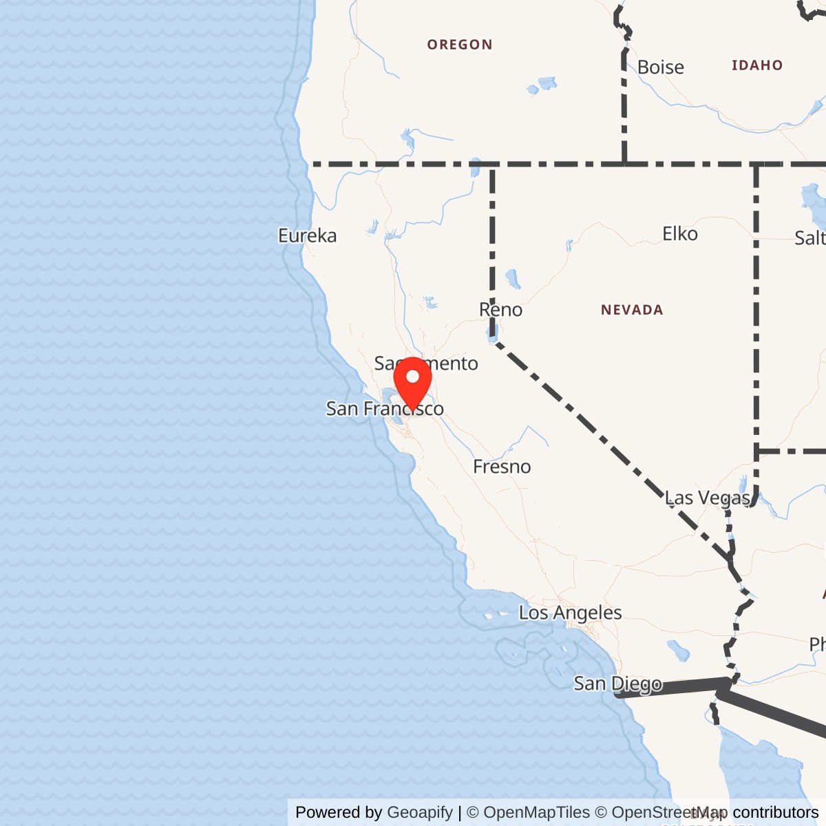
Longitude: -121.79
Current Role: Former Livermore CAA Intermediate Field acquired by the Navy on 1942-03-24 as OLF Livermore; expanded later in 1942 to 261 acres and documented as Outlying Field 'L' / Livermore Intermediate; later Livermore Sky Ranch and municipal airport before the older field was replaced by the current Livermore Municipal Airport west of the site and redeveloped for residential/civic use; no active Navy use.
Naval Outlying Landing Field Livermore occupied a small but unusually important patch of aviation ground in the Livermore Valley. Unlike many of NAS Livermore's wartime outlying strips, it was not simply a newly improvised wartime sod field. It began as Livermore's earlier civil airport and CAA Intermediate Field, a grass landing area associated with airway navigation before the Navy absorbed it into the wartime naval aviation training network. That prewar identity mattered. The Navy did not have to invent the site from scratch. It took over an already recognized landing field, expanded it, and folded it into a larger training and emergency-landing system that surrounded NAS Livermore.
The field's location made tactical sense. NAS Livermore itself sat to the east, on the wartime air station site that later became Lawrence Livermore National Laboratory. Outlying Field Livermore lay closer to town, northwest of downtown Livermore, giving student pilots and later operational aircraft a nearby off-site field that could absorb practice landings, emergency landings, and overflow activity without putting every sortie onto the crowded main station. The field was close enough to serve NAS Livermore directly, yet separate enough to function as a training and safety valve.
The correct identity is therefore narrower than "NAS Livermore," but more substantial than a casual farm strip. It was the former Livermore CAA Intermediate Field, federally acquired by the Navy on March 24, 1942, commissioned as Outlying Field Livermore, expanded later that year, and documented in Navy planning material as Outlying Field "L," Livermore Intermediate. It later returned to civilian airport use as Livermore Sky Ranch and Livermore Municipal Airport before being replaced by the current Livermore Municipal Airport site and redeveloped.
Mission and Operation
The Navy's use of the field grew directly out of the Bay Area's wartime pilot-training problem. Naval aviation expanded faster than prewar airport infrastructure could support. Oakland's Navy air facilities became crowded, and Livermore became one of the relief points where the Navy could train primary pilots and then support carrier-aircraft staging and reserve activity. A primary flight-training station required more than one runway. Student pilots needed repeated landings, emergency practice, and low-intensity fields away from the main base traffic pattern. OLF Livermore helped supply that margin.According to the airfield-history source drawing on Dan Sebby of the California State Military Museum, the Navy Department acquired 111 acres of the Livermore CAA Intermediate Field on March 24, 1942 by federal condemnation against owner James Anderson. The field was commissioned as Outlying Field Livermore. On November 27, 1942, the site expanded by 150 acres through federal condemnation against Gandolfo Gudetti, bringing the field to about 261 acres and allowing the addition of a north-south runway. Those dates are important because they distinguish OLF Livermore from the less-documented outlying fields whose exact acquisition history is harder to trace.
A 1943 U.S. Navy plan identified the site as Outlying Field "L," Livermore Intermediate, and showed it attached to NAS Oakland. The plan described a federal property of 261 acres with a single unpaved east-west runway of about 3,700 feet, surfaced in heavy sod and gravel, with construction still in progress. By the 1945 Army-Navy Directory of Airfields, the site was described as the Livermore Naval Air Station Auxiliary, also identified as Livermore Intermediate Field, with two gravel-and-sod runways: a 4,000-foot north-south runway and a 3,700-foot east-west runway. The directory noted that the field had no hangars or services, confirming that it was an auxiliary training and emergency field rather than a self-contained air station.
During the primary-training period, OLF Livermore would have supported student pilots operating aircraft such as the Stearman N2S Kaydet, Naval Aircraft Factory N3N, and Timm N2T Tudor. These aircraft fit the field's mission well. They were primary trainers, used heavily in repeated takeoff-and-landing work, pattern flying, and basic flight instruction. A sod-and-gravel auxiliary field did not need the full maintenance plant of a major naval air station to serve that purpose. It needed safe approaches, usable runways, and proximity to the parent base.
As NAS Livermore's role shifted in late 1944 from primary flight training toward carrier-aircraft staging and operational support, OLF Livermore's mission broadened accordingly. The field could serve as an emergency landing area and overflow staging point when the main base was congested. Carrier-type aircraft such as F6F Hellcats, F7F Tigercats, F4U Corsairs, TBM Avengers, and SB2C Helldivers were associated with the later Livermore network. OLF Livermore was not the main place where those aircraft were maintained or staged, but it was part of the surrounding aviation safety and capacity system that made a busy wartime air station workable.
Role in the Wider Military Network
OLF Livermore only makes sense as part of a network. It was one of the 12 sod outlying fields that supported NAS Livermore's primary-training mission. The 1944 Army/Navy Directory-derived list places it alongside Abel, Brown, Brown-Fabian, Cope, Gelderman, Heath, Lindeman, Mays School, Rita Butterworth, Spring Valley, and Wagoner. Together these fields created a dispersed landing network around the Livermore Valley and nearby East Bay communities. That network reduced congestion, gave students more landing options, and distributed training away from the main station.Its administrative context also changed over time. The 1943 Navy plan attached Outlying Field "L" to NAS Oakland, reflecting the way Oakland's Naval Reserve and training activity drove early Livermore-area naval aviation expansion. As NAS Livermore developed and took on its own identity, OLF Livermore became one of the Livermore outlying fields. The Navy's World War II California activity list identifies Naval Air Station Livermore, Wagoner Field, and a Combat Aircrew Refresher Training Unit at NAS Livermore, which confirms that Livermore had both a main station and a wider supporting aviation system.
This makes OLF Livermore different from NAS Livermore itself. The air station was the command, training, ramp, and support center. OLF Livermore was a satellite field. It did not replace the main station, and it did not have the same postwar destiny. NAS Livermore became a national laboratory site. The older OLF Livermore field returned to civilian airport use, operated as Livermore Sky Ranch and municipal airport property, and was later replaced by a new airport location.
Postwar Civilian Reuse
After World War II, the field moved back toward civil aviation. Airfield-history sources note that after NAS Livermore operated as a Naval Reserve aircraft home until 1950 and then transferred to the Atomic Energy Commission, the remaining Livermore outlying fields became surplus to Navy needs. OLF Livermore appears to have returned to civilian use before the final paper trail ended, since it was shown as Livermore Sky Ranch on the March 1949 San Francisco Local Aeronautical Chart with a 4,000-foot unpaved runway.A 1949 aerial view showed the airport with two grass runways, the word "Livermore" marked in large letters, and small hangars on the northeast side. An August 1952 General Services Administration report described the former OLF facilities as a 4,000-foot gravel runway, a 3,700-foot sod runway, three hangars, a wood-frame flight-operations building, a line shack, and a 51-foot steel beacon tower. The GSA quitclaimed the property to the City of Livermore on October 22, 1953, and the city operated it as Livermore Sky Ranch.
The 1953 USGS map labeled the field both as an inactive Naval Auxiliary Air Field and as Livermore Sky Ranch. Through the late 1950s and early 1960s, the site remained a busy local airport. The older field, however, was constrained by surrounding development and by the city's growing need for a more suitable general-aviation airport. Livermore's current municipal airport site opened in December 1965, west of the old field. City material identifies the present airport as a city-owned general aviation reliever airport, while AirNav lists KLVK as a public airport activated in December 1965. That current airport is the successor to Livermore's municipal aviation function, but it is not the same ground as the former Navy OLF.
Current Status
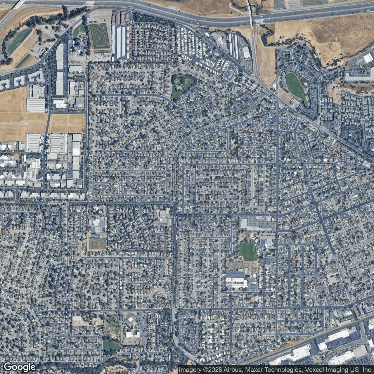
The original OLF Livermore site is closed and has no active Navy or aviation function. After the current Livermore Municipal Airport opened to the west in 1965, the older airport disappeared from aeronautical charts. Airfield-history sources report that by 1979 housing covered the old site and that by 2006 no recognizable trace of the former OLF remained. The former field area is now part of Livermore's residential and civic landscape, with residential lots, an elementary school, and city parks occupying land that had once been the CAA Intermediate Field, the Navy's Outlying Field "L," and Livermore Sky Ranch.
Chronology
- 1929 Livermore Airport was designated as a CAA Intermediate Field, part of an emergency-landing network for civil airways.
- 1930 A Richfield Airport Directory aerial view showed Livermore Airport as a grass field with airway marking and a beacon.
- 1939 Aerial imagery showed the field as an irregular grass airport with a central airfield-circle marking and small buildings.
- 1940 The USGS topo map depicted Livermore Airport as an outlined airfield area.
- 1941-12 The San Francisco Sectional Chart depicted Livermore Intermediate Field as Site 33 along the airway.
- 1942-03-24 The Navy acquired 111 acres of Livermore CAA Intermediate Field through federal condemnation against airport owner James Anderson and commissioned the site as Outlying Field Livermore.
- 1942-11-27 The Navy acquired an additional 150 acres through federal condemnation against Gandolfo Gudetti, allowing construction of a north-south runway.
- 1943 A U.S. Navy plan identified the site as Outlying Field "L," Livermore Intermediate, attached to NAS Oakland and consisting of 261 acres.
- 1944 The 1944 Army/Navy Directory-derived list identified NOLF Livermore as one of NAS Livermore's outlying fields, with a 4,000-foot runway.
- 1945 The Army-Navy Directory described the Livermore Naval Air Station Auxiliary, Livermore Intermediate Field, as a 260-acre field with two gravel-and-sod runways.
- 1945-03 The San Francisco Sectional Chart depicted the field as Livermore (Navy).
- 1949-03 The San Francisco Local Aeronautical Chart depicted the field in civilian use as Livermore Sky Ranch with a 4,000-foot unpaved runway.
- 1952-08 A GSA excess-property supplement described the field's remaining facilities, including a 4,000-foot gravel runway, a 3,700-foot sod runway, three hangars, an operations building, a line shack, and a beacon tower.
- 1953-10-22 The General Services Administration quitclaimed the former OLF site to the City of Livermore.
- 1953 The USGS topo map labeled the field both as Naval Auxiliary Air Field (Inactive) and Livermore Sky Ranch.
- 1959 The San Francisco Local Aeronautical Chart depicted Livermore Sky Ranch as having a 4,000-foot unpaved runway.
- 1961 The USGS topo map labeled the field as Municipal Airport.
- 1965-12 The current Livermore Municipal Airport opened west of the former Navy OLF, replacing the older airport site.
- 1966 The old Livermore Airport was no longer depicted on the San Francisco Sectional Chart.
- 1979 Aerial imagery showed housing covering the site of the original Livermore Airport.
- Present The former OLF Livermore site is residential and civic land with no active Navy or aviation use; the separate current Livermore Municipal Airport remains active as KLVK.
Sources & References
- WEB Abandoned & Little-Known Airfields Livermore Intermediate Field / Livermore Naval Outlying Landing Field / Livermore Sky Ranch / Livermore Municipal Airport
- WEB U.S. Naval Activities, World War Two, By State California
- WEB City of Livermore Livermore Airport (LVK)
- WEB City of Livermore Airport Projects
- WEB AirNav KLVK Livermore Municipal Airport
- WEB California State Military Museum / California Military Department Naval Air Station Livermore