
Naval Outlying Landing Field Abel / Warm Springs Airport, California
Longitude: -121.906
Current Role: Former NAS Livermore outlying landing field at Abel / Warm Springs; documented in the 1944 Army/Navy Directory as Abel OLF, Navy, with a 3,800-foot unpaved runway; briefly reused as Warm Springs / Milpitas glider airport before 1952 closure and residential redevelopment; no active Navy or aviation use.
Naval Outlying Landing Field Abel was one of the small World War II landing fields that made the Bay Area's naval flight-training system work. It was not a naval air station with hangars, barracks, shops, and a resident command community. It was a satellite landing field, a simple grass or turf training strip where student pilots could practice landings and takeoffs away from the traffic, noise, and congestion of a main air station. That modest physical identity is exactly what gave Abel its wartime value. Naval aviation needed thousands of new pilots, and those pilots needed repetition. Every circuit, bounce, go-around, and emergency landing could not be squeezed into the same runways used by a main training station.
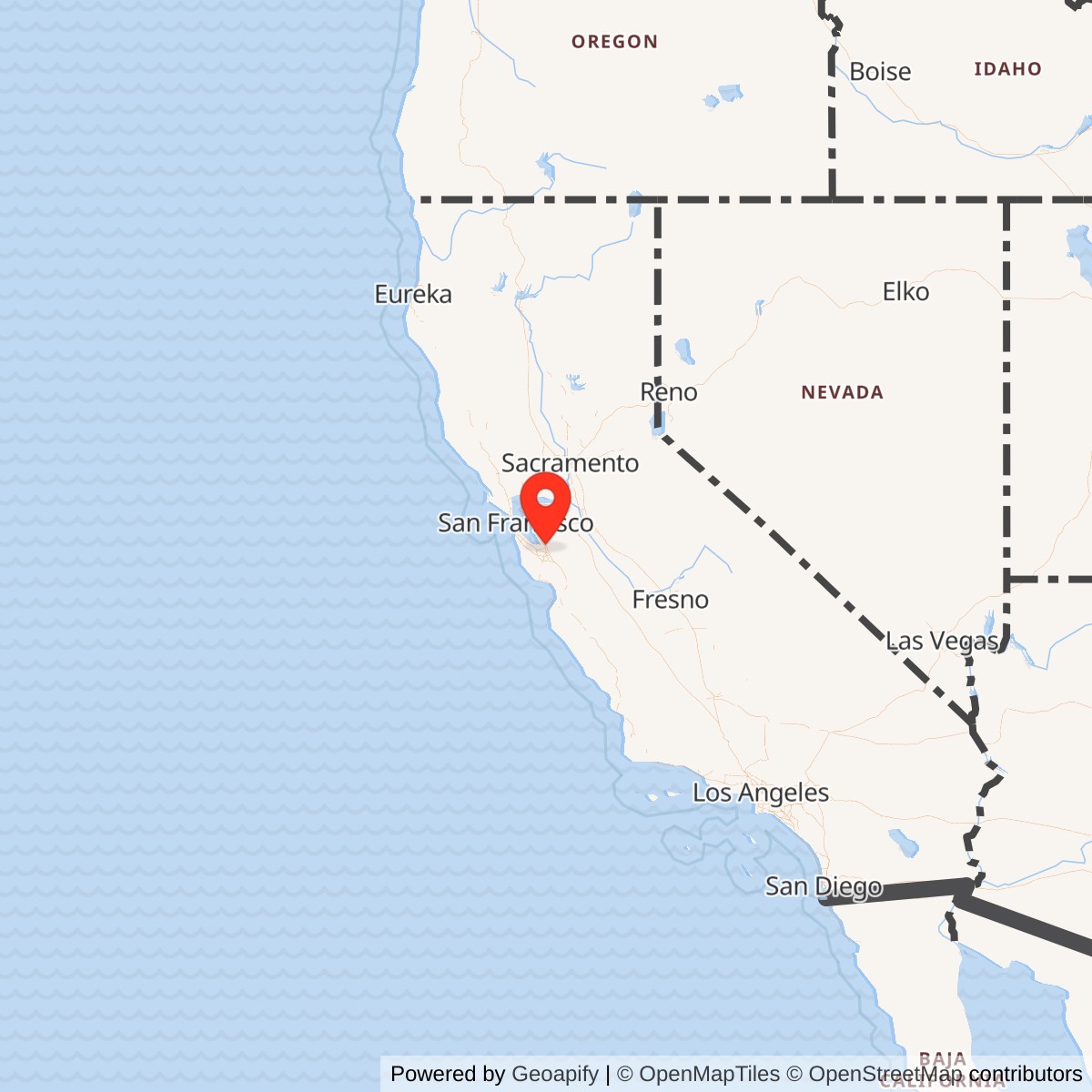
The field lay in the Warm Springs and Milpitas area of the southern East Bay,. Airfield-history mapping places the site southeast of San Francisco and near what later became a residential area centered around Albert Augustine Park in Milpitas. During the war the Navy identified it as Abel OLF or Abel Field, and the 1944 Army/Navy Directory of Airfields listed "Abel OLF, Navy" as an outlying landing field to Naval Air Station Livermore with a 3,800-foot unpaved runway. Another wartime description reported a 2,500-foot turf runway, which may reflect a different date, measured landing area, or incomplete early field condition. In both descriptions, the important point is the same: Abel was a simple, unpaved World War II naval landing field built for training rather than for a full base population.
The installation also had a short postwar civil-aviation life. After the Navy no longer needed Abel, the field continued as Warm Springs Airport, also remembered locally as Milpitas Airport or Warm Springs Gliderport. By the late 1940s and early 1950s, it supported light aircraft, glider flying, model airplane activity, training, charters, and repairs. That postwar use did not last. Local airfield-history sources report that the field closed to glider and model-aircraft flying in October 1952, disappeared from the 1953 USGS topographic map, and was mostly covered by housing in 1953. No recognizable airfield trace remained by the twenty-first century.
Mission and Military Role
Abel's mission was primary flight-training support. In the early wartime buildup, the Navy was using fields tied to Naval Reserve Aviation Base Oakland. Airfield-history research citing Navy documents reports Abel as early as December 1941 among fields to be used by that Oakland-based training system. When the primary training mission shifted to the new Livermore naval air station in 1942, the Navy reorganized the surrounding outlying-field network. Some older Oakland-associated fields were abandoned, while fields closer to Livermore were opened or retained.Abel's role within that network was practical and repetitive. It gave student pilots a place to practice the most basic but most unforgiving parts of flying: approach, touchdown, rollout, takeoff, and pattern work. The field did not need elaborate permanent facilities to be useful. A reasonably clear landing area, recognizable boundaries, and enough open ground around it could support hundreds or thousands of training movements during the war. A 1943 diagram showed Abel as a square-shaped field. A 1943 Navy aerial view from the NAS Livermore Air Operations Manual showed the field boundaries and distances, and a July 1, 1944 U.S. Navy aerial view showed six trainer biplanes on the field. That image captures the field's role better than a large facilities list could: Abel existed so training aircraft could keep moving.
The aircraft associated with the Livermore outlying-field system were primary trainers, including types such as the Stearman N2S Kaydet, Naval Aircraft Factory N3N "Yellow Peril," and Timm N2T Tudor. Those aircraft were durable, slow, and well suited to student work, but they still required large amounts of safe landing space. Abel's open farmland setting gave the Navy a place where inexperienced pilots could make mistakes with less risk to the main station and less interference from other air traffic. This was the quiet infrastructure behind the Navy's wartime pilot pipeline.
Site Design and Facilities
The evidence points to Abel as a minimal-support field. Its wartime diagrams and aerial photographs show a square or nearly square landing area rather than a complex military airfield. One reported runway length was 2,500 feet of turf, while the 1944 Army/Navy Directory listed a 3,800-foot unpaved runway. The site had no documented permanent hangar complex, barracks area, fuel farm, or large naval administrative cantonment. It was the sort of field that could be established quickly on open land, marked for student use, and supervised as part of a broader air-operations network.The field's location in what was then a far less developed Warm Springs and Milpitas landscape was part of the design logic. The surrounding agricultural land created an open safety buffer and gave the Navy enough room for student operations. The July 1944 aerial view showing six trainer biplanes also shows how sparse the surrounding development was at the time. In that sense Abel was a wartime field that depended on a landscape that no longer exists. The same open land that made it useful in 1943 and 1944 became valuable postwar residential land by the early 1950s.
Role in the Wider Military Network
Abel only makes sense as one part of the NAS Livermore and Oakland naval aviation training system. Naval Air Station Livermore itself was built in 1942 east of Livermore to relieve overcrowding at the naval aviation facilities at Oakland. The Navy's World War II activity list identifies Naval Air Station Livermore and Wagoner Field at Livermore, and airfield-history research identifies a wider set of Livermore-associated outlying fields that included Abel, Brown, Brown-Fabian, Cope, Gelderman, Heath, Linderman, Livermore Airport, Mays School, Rita Butterworth, Spring Valley, and Wagoner.That network mattered because wartime pilot training was a system of distribution. The main air station handled command, administration, instruction, aircraft support, and higher-density operations. The outlying fields absorbed repetitive landing practice, emergency-field training, and overflow. By spreading training across many small fields, the Navy reduced congestion and gave student pilots more time in the pattern. Abel was one of the smallest pieces of that system, but the system depended on many such pieces.
The field also shows how the Navy adapted civilian and rural air landscapes in wartime. Rather than build every airfield from scratch as a permanent station, the Navy used or improved suitable open fields, crop-dusting strips, barnstorming fields, and local airports when speed mattered. Abel's later postwar use as Warm Springs Airport and Warm Springs Gliderport reinforces that continuity. The same ground could serve naval training during the war and then revert to local light-aircraft and glider activity once military demand passed.
Postwar Reuse and Current Status
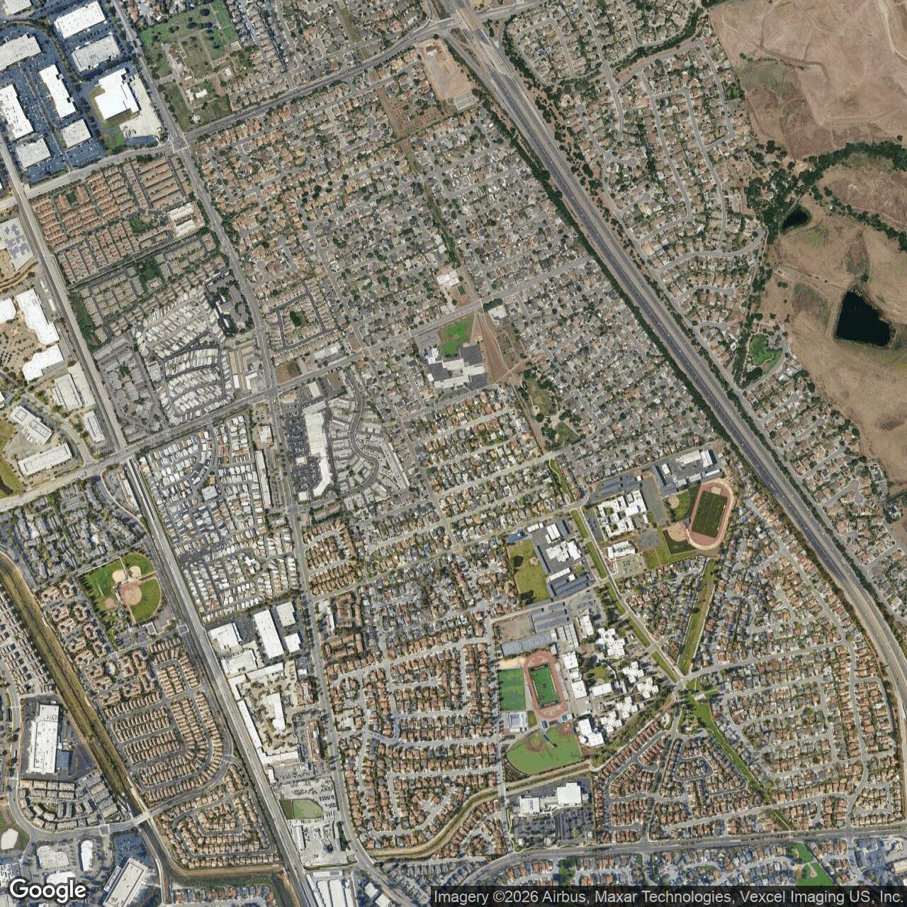
After World War II, Abel's aviation life continued briefly in civilian form. Local aviation memory identifies the site as Milpitas Airport and Warm Springs Airport, and soaring history places the Northern California Soaring Association's early activity at the Warm Springs grass strip in 1947. The field's position near Mission Ridge made it attractive to glider pilots because local air currents and ridge effects created useful soaring conditions. A 1948 airport directory described Warmsprings Airport as a private field offering training, charter work, repairs, and field services. A 1951 Airman's Directory listed Warm Springs as a 2,800-foot all-way turf landing field considered suitable for gliders.The airport's closure followed the rapid postwar development of the East Bay. Airfield-history sources report that flying by gliders and radio-control aircraft ended there in October 1952. The 1953 USGS map no longer showed the airport, and aerial photos showed houses being built over most of the former field in 1953. A single hangar survived for a time on the west side, but it was razed between 1959 and 1966. By 2017 no recognizable trace of the airfield remained. The site is now part of the built-up Milpitas residential landscape around Sunnyhills Albert Augustine Jr. Memorial Park and nearby streets.
Chronology
- December 1941 Navy documents for Naval Reserve Aviation Base Oakland reportedly mention Abel OLF as one of the fields to be used by that station.
- 1942 Primary naval flight training shifted toward the newly built Naval Air Station Livermore, and some Oakland-associated fields were abandoned while fields closer to Livermore were opened or retained.
- 1943 A diagram depicted Abel as a square-shaped outlying landing field.
- 1943 A U.S. Navy aerial view from the NAS Livermore Air Operations Manual documented Abel Field, also identified as Field A, and showed its boundaries and distances.
- 1944-07-01 A U.S. Navy aerial view showed six trainer biplanes at Abel OLF.
- 1944 The Army/Navy Directory of Airfields listed "Abel OLF, Navy" as an outlying landing field to NAS Livermore with a 3,800-foot unpaved runway.
- 1945 Navy outlying-field use ended as wartime training requirements declined.
- 1947 Soaring enthusiasts gathered at Warm Springs Airport and organized early Northern California soaring activity at the former field.
- 1948 Warmsprings Airport appeared in airport-directory and aeronautical-chart sources as a private, unpaved field.
- 1951 The Airman's Directory listed Warm Springs as a 2,800-foot all-way turf landing field well suited to glider use.
- 1952-10 Local model-aircraft and glider history records the end of flying use at the field.
- 1953 The field was no longer shown on the USGS topographic map, and housing covered much of the former airfield.
- 1959-1966 The remaining Warm Springs hangar was removed.
- 2017 Aerial imagery showed no recognizable airfield trace.
- Present The former NOLF Abel / Warm Springs Airport site is a residential area around the Sunnyhills Albert Augustine Jr. Memorial Park area in Milpitas, with no active Navy or aviation use.
Sources & References
- WEB Abandoned & Little-Known Airfields NOLF Abel / NOLF Coelho / Warm Springs Airport (2nd location), Warm Springs, CA
- WEB U.S. Naval Activities, World War Two, By State [California], Naval Historical Center transcription hosted by HyperWar
- WEB Lawrence Livermore National Laboratory Our History
- WEB City of Milpitas Sunnyhills Albert Augustine Jr. Memorial Park