
Ohlson Mountain Air Force Station, Alaska
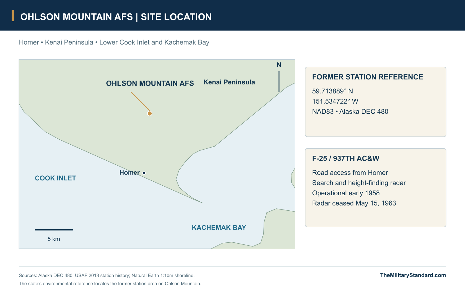
The 937th Squadron operated search and height-finding radar from a road-accessible summit above Homer and Kachemak Bay.
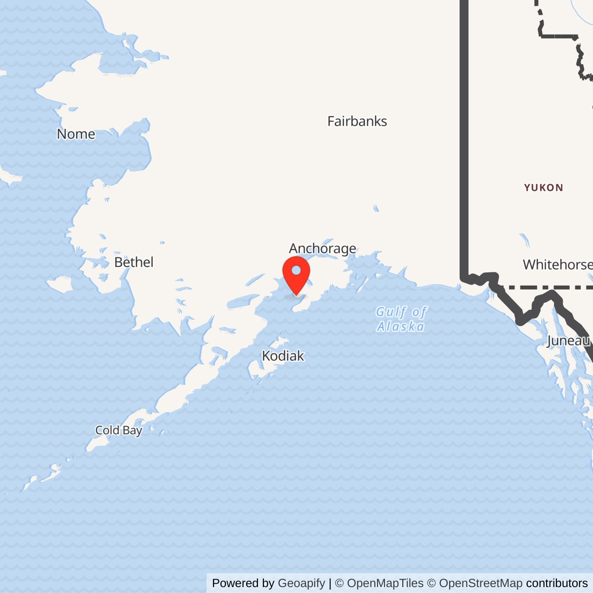
Longitude: -151.534722
Site Number: F-25
Current Role: Radar station closed in 1963.
- Station code
- F-25
- Military role
- Ground-controlled-interception radar station in the Alaska AC&W system
- Operating unit
- 937th Aircraft Control and Warning Squadron
- Original search radar
- AN/FPS-3
- Height finder
- AN/FPS-6
- 1961-1962 search upgrade
- AN/FPS-20A
- Radar operating period
- Early 1958-May 15, 1963
- Historical area
- 70 acres; later research lease covered 3.67 acres
- Nearby communications site
- Diamond Ridge White Alice
- Location
- Ohlson Mountain above Homer and Kachemak Bay, Kenai Peninsula Borough
- Latitude / longitude
- 59.713889, -151.534722; NAD83 former-station environmental reference (DEC 480)
A Radar Station Above Homer
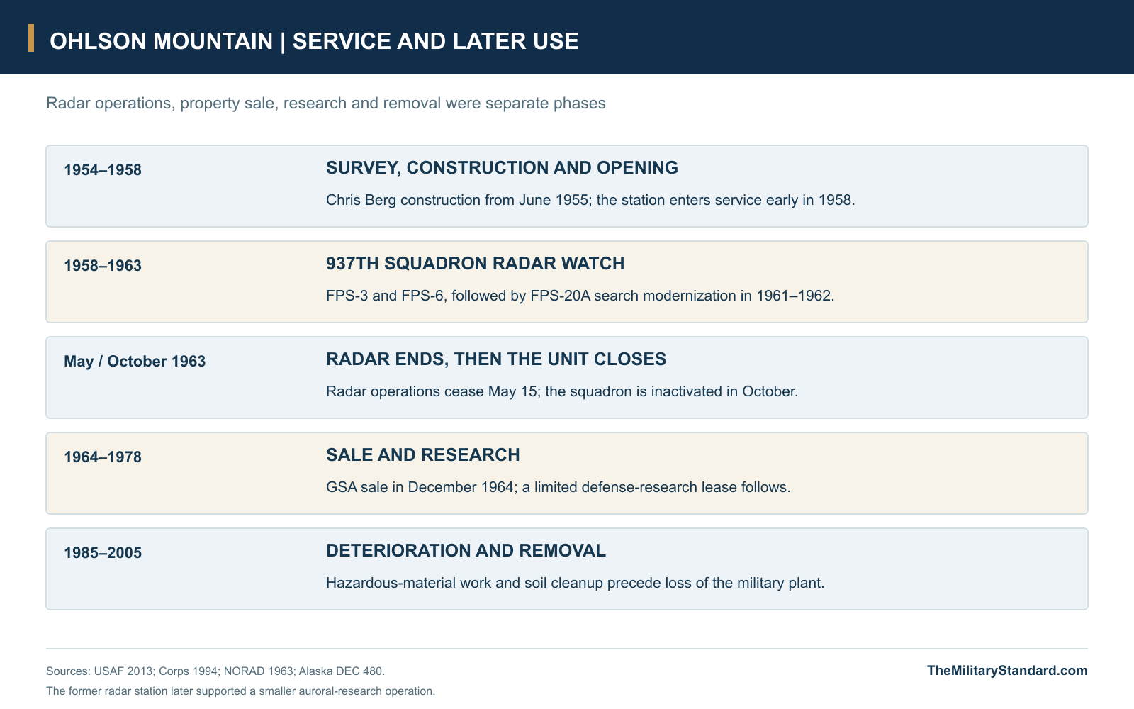
Ohlson Mountain Air Force Station occupied a hilltop above Homer during the final expansion of Alaska's permanent Cold War radar screen. The 937th Aircraft Control and Warning Squadron operated search and height-finding equipment there, using the position to watch the southern approaches to the territory and contribute to the wider air-defense system. Its operational life was brief, beginning in early 1958 and ending in May 1963, but its compact plant brought together radar, communications, power generation and accommodation in a distinctive summit community. [1] [2] [3]
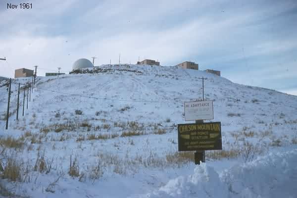
The installation was unusual among Alaska's warning posts because it could be reached and supplied by road. Homer lay below it on the Kenai Peninsula, beside Kachemak Bay and lower Cook Inlet, giving the station a connection to an established community that many remote coastal sites lacked. That access eased the movement of stores, equipment and personnel, although snow and the exposed hilltop still shaped daily work. The road also helped connect military recreation with the developing skiing community around Homer. [1] [6] [7]
Survey, Construction and the 937th Squadron
Alaskan Air Command and Corps of Engineers representatives surveyed the location in the latter part of 1954. The new station belonged to a second group of permanent sites intended to improve the coverage left by the original warning network. Construction began in June 1955 under a contract awarded to Chris Berg of Seattle. Building on the summit required a prepared pad, an access road and the supporting services needed to keep both men and electronic equipment functioning through an Alaska winter. [1] [2]
The 937th Aircraft Control and Warning Squadron was activated in 1957 as the operating organization took shape. The Air Force station history places it initially within the 5040th Aircraft Control and Warning Group and records subsequent changes in higher headquarters under Alaskan Air Command. Those administrative relationships formed the framework around the permanent local task: maintaining the radar sets, operating the watch and keeping the station ready to provide useful information to the defense system. [1]
The station entered service in early 1958. NORAD's July 31 equipment roster lists Ohlson Mountain as F-25, with the 937th Squadron and both search and height-finding radar in the ground-controlled-interception category. That contemporary listing places the station firmly within the operational Alaska network by the summer. Its equipment and trained watch personnel gave the command a new source of aircraft position and height information from the Kenai Peninsula. [1] [2] [3]
The Summit Compound
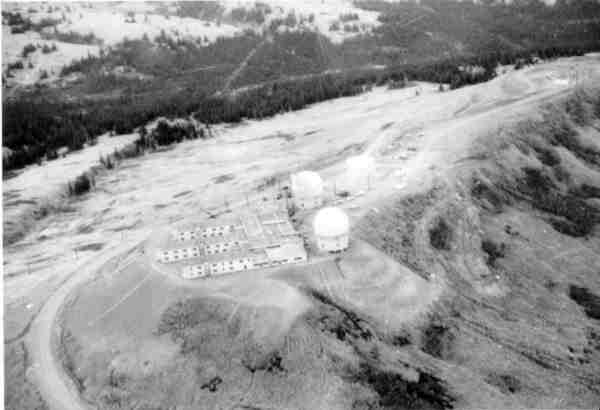
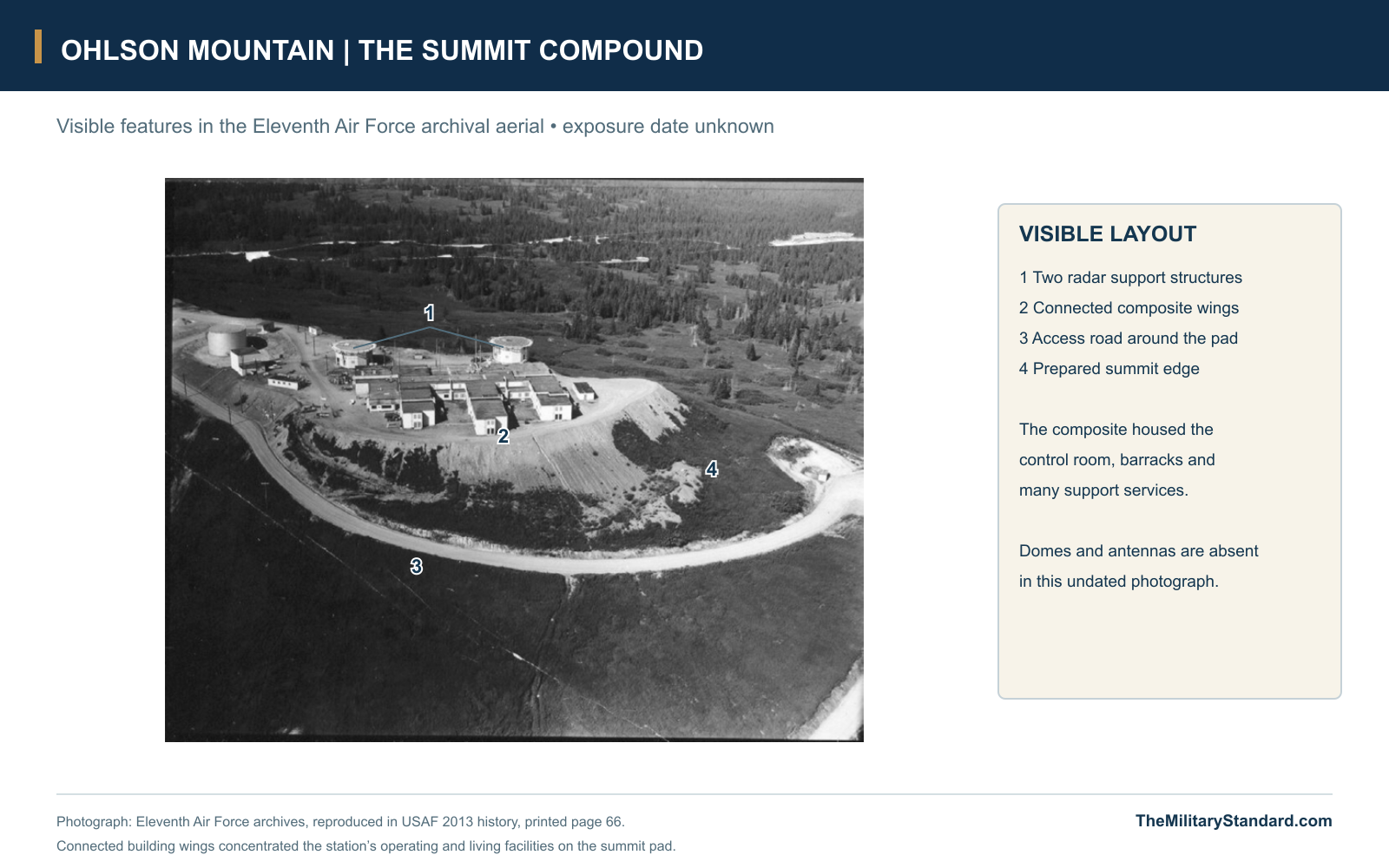
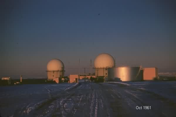
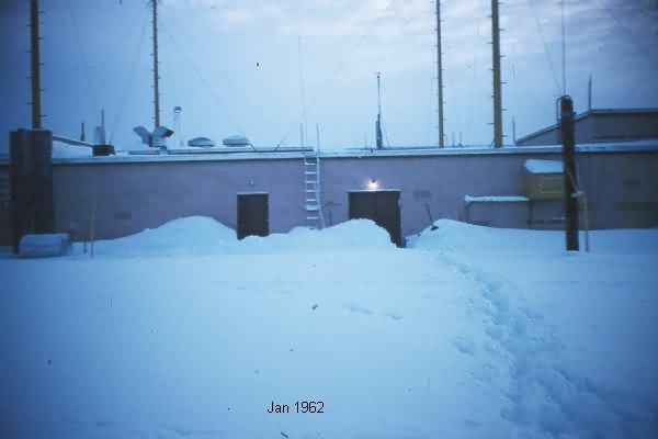
Ohlson Mountain used a compact arrangement of connected buildings rather than a widely separated lower camp and mountain radar post. The Corps describes eleven two-story wood-frame buildings in a design similar to Middleton Island. A large composite structure concentrated accommodation and many operating services beside the two radar foundation structures. Historical aerials show the building wings grouped on a prepared summit pad, with an access road curling around the development and separate tanks and utility buildings nearby. [1] [2] [5]
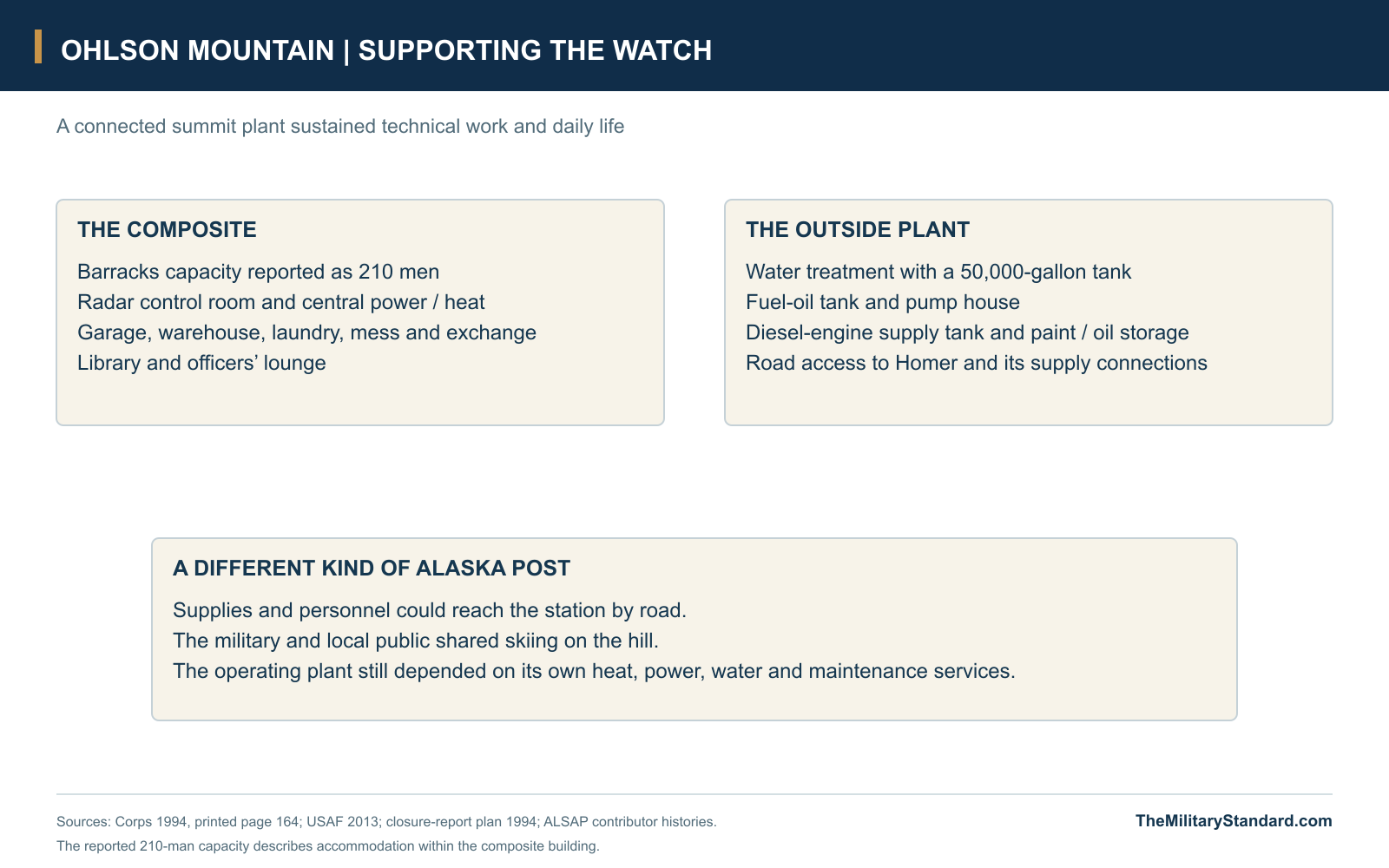
The composite building contained barracks with a stated capacity of 210 men, a radar control room, central power and heating plant, garage, laundry, library, warehouse, mess, exchange and officers' lounge. The Corps' later inspection described an overall structure approximately 240 by 220 feet. These figures indicate the scale of the plant and its accommodation, rather than a documented daily headcount. Concentrating so many functions reduced movement between detached buildings and tied the station's domestic routines closely to its technical mission. [2]
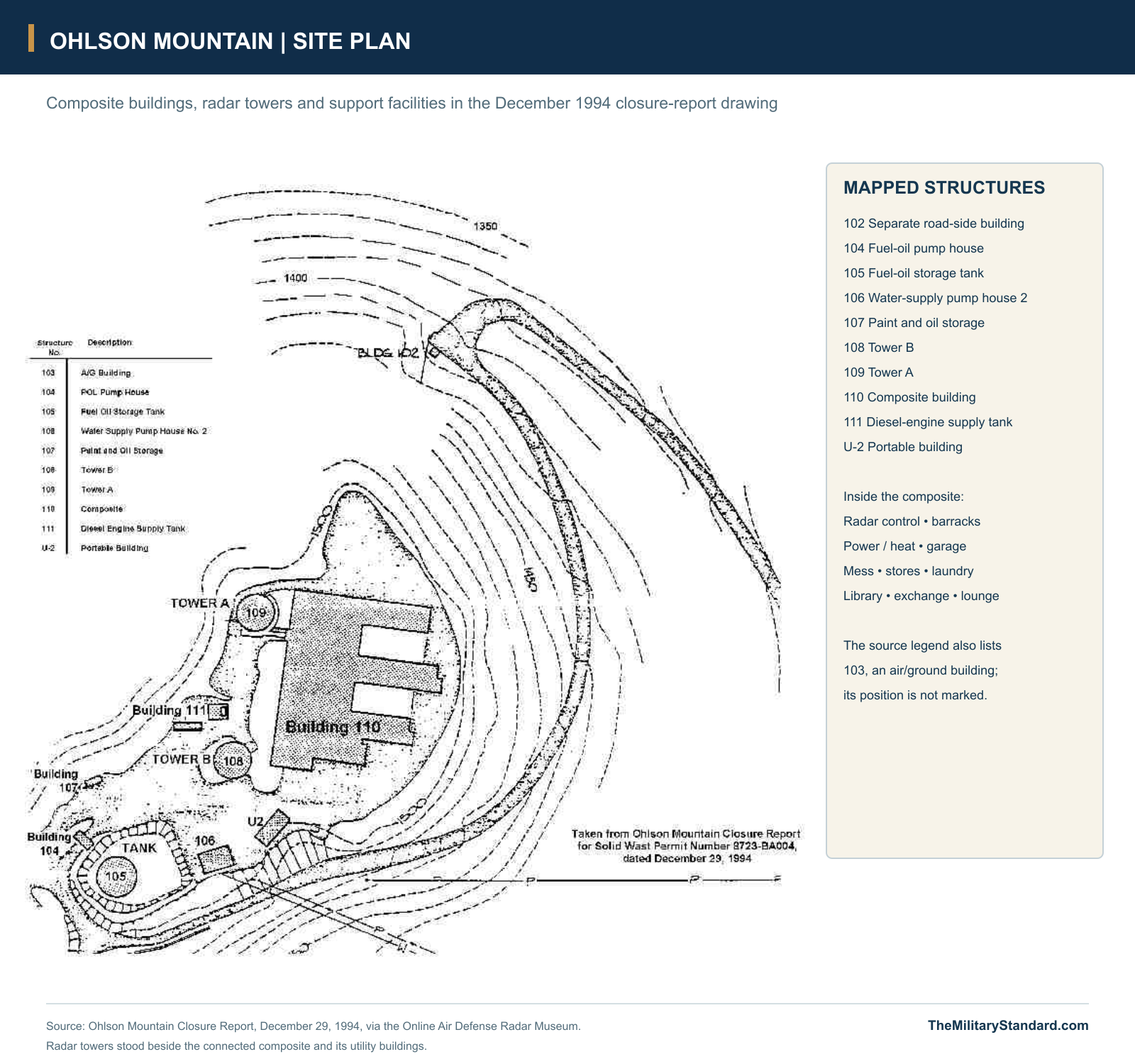
The closure-report plan identifies the composite as Building 110 and the radar supports as Tower A, Structure 109, and Tower B, Structure 108. The same drawing shows a fuel-oil tank and pump house, diesel-engine supply tank, paint and oil storage, water-supply facilities and a portable building. A separate structure appears farther along the access road. The plan records the later footprint of the former military plant, while the archival aerial preserves the connected wings and two prominent radar supports before the site's eventual clearance. [1] [5]
Search, Height Finding and the Radar Watch
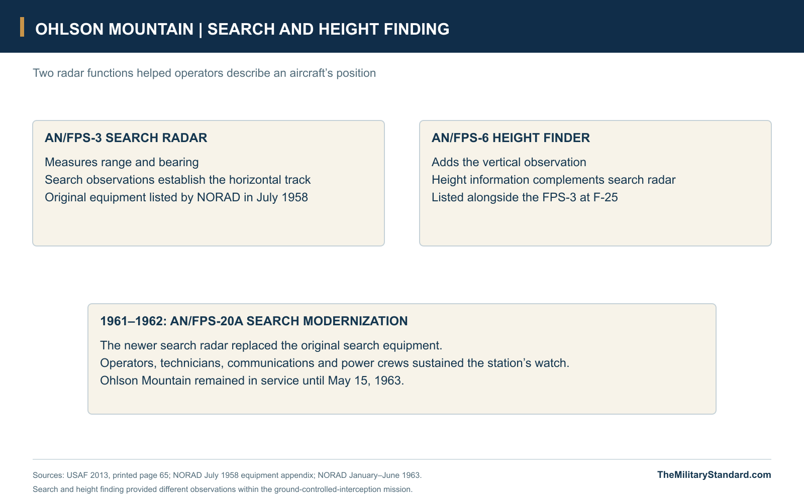
The original equipment paired an AN/FPS-3 search radar with an AN/FPS-6 height finder. The search set supplied range and bearing observations across a broad sweep, while the height-finding equipment added the vertical information needed to describe a target's position. Operators had to bring those observations together into a useful track. NORAD's 1958 appendix identifies both radar families and a GCI function at Ohlson Mountain, distinguishing it from the coastal posts listed only for early warning. [1] [3]
Ground-controlled interception connected radar observation to decisions about aircraft identification and response. The local watch formed part of a command structure that included regional control facilities and the interceptor organization, with Fire Island serving as the southern master station near Anchorage. The value of Ohlson Mountain lay in the observations and control work its personnel could contribute within that larger arrangement. Radar technicians, operators and communications personnel each supported a different part of the same chain. [1] [3]
The station was re-equipped with an AN/FPS-20A search radar in 1961-1962. This modernization came only a short time before closure, illustrating that equipment improvement and decisions about the number of stations could follow different schedules. A more capable radar could improve an individual post while broader reviews changed the value placed on its geographic coverage. Ohlson Mountain's career consequently included a significant search-radar upgrade followed by a rapid end to the staffed mission. [1] [4]
Power, Water and Road Supply
The radar watch depended on the plant around it. Electrical generation and central heating occupied the composite building, with fuel facilities supporting engines and the wider station. The later structure inventory identifies Building 104 as a fueling building housing a small generator set, while the site plan distinguishes the fuel-oil pump house and the diesel-engine supply tank. Mechanics, utility personnel and supply staff sustained the equipment and buildings that allowed the operating sections to remain on duty. [2] [5]
Water required a plant of its own. The Corps' inspection describes a water-treatment building with a 50,000-gallon welded-steel tank, associated piping and pump equipment. Stores, workshops, laundry and the mess connected those utilities to everyday life in the barracks. Road access to Homer made replenishment easier than at an isolated island or coastal station, but it did not remove the need to keep essential services operating locally. A failure in heat, water or electric power would affect the community and the radar mission together. [1] [2] [5]
Diamond Ridge and the Communications Landscape
The Homer area also contained Diamond Ridge White Alice, a separate communications station with a different role and physical plant. The Corps inventory describes a mixed troposcatter and microwave installation, linking toward Big Mountain and Pillar Mountain through large reflectors and toward Starisky Creek through a microwave path. That system helped connect Alaska's widely scattered military and civilian communications points. Its equipment building, antenna systems and later operating history belonged to the relay station rather than to the two radar towers at Ohlson Mountain. [2] [10]
Both installations grew from the military's need to combine observation with reliable communication across Alaska. At Ohlson Mountain, search and height-finding sets produced aircraft information; at Diamond Ridge, radio equipment carried traffic between distant points in the communications network. Their proximity helps explain the concentration of Cold War infrastructure in the Homer area. The radar post's short operating period and the relay's longer history nevertheless followed different schedules, with each site retaining its own identity in the landscape. [1] [2] [3] [10]
Skiing and the Homer Community
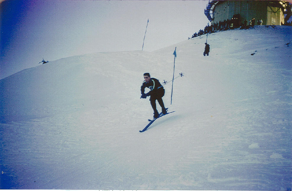
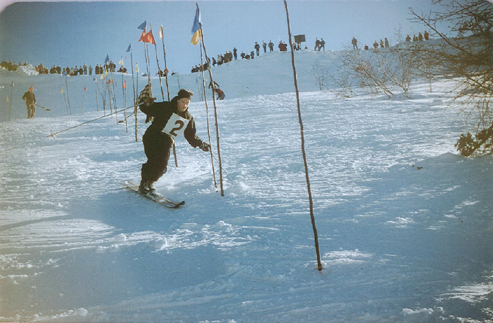
The Air Force hill became part of Homer's skiing life as well as a place of military work. Contributor accounts describe a rope tow used by service personnel and the public, with Kachemak Ski Club races on the north and west sides of the station. John "Jake" McLay's photographs show racers negotiating gates on these slopes in the 1960s, sometimes with radar structures visible above them. The setting joined an operational hilltop with a community activity that made practical use of its snow and relief. [6]
The club's own history describes a longer sequence of local ski hills and tow relocations. Homer skiers had already worked with modest equipment and changing sites as they sought useful snow and terrain. Moving activity toward Ohlson Mountain continued that local pattern, while the station added a conspicuous military neighbor to the scene. The photographs preserve this connection particularly well: skiers and spectators occupied the slopes below the same skyline that carried the radar domes. [7]
The Decision to Close in 1963
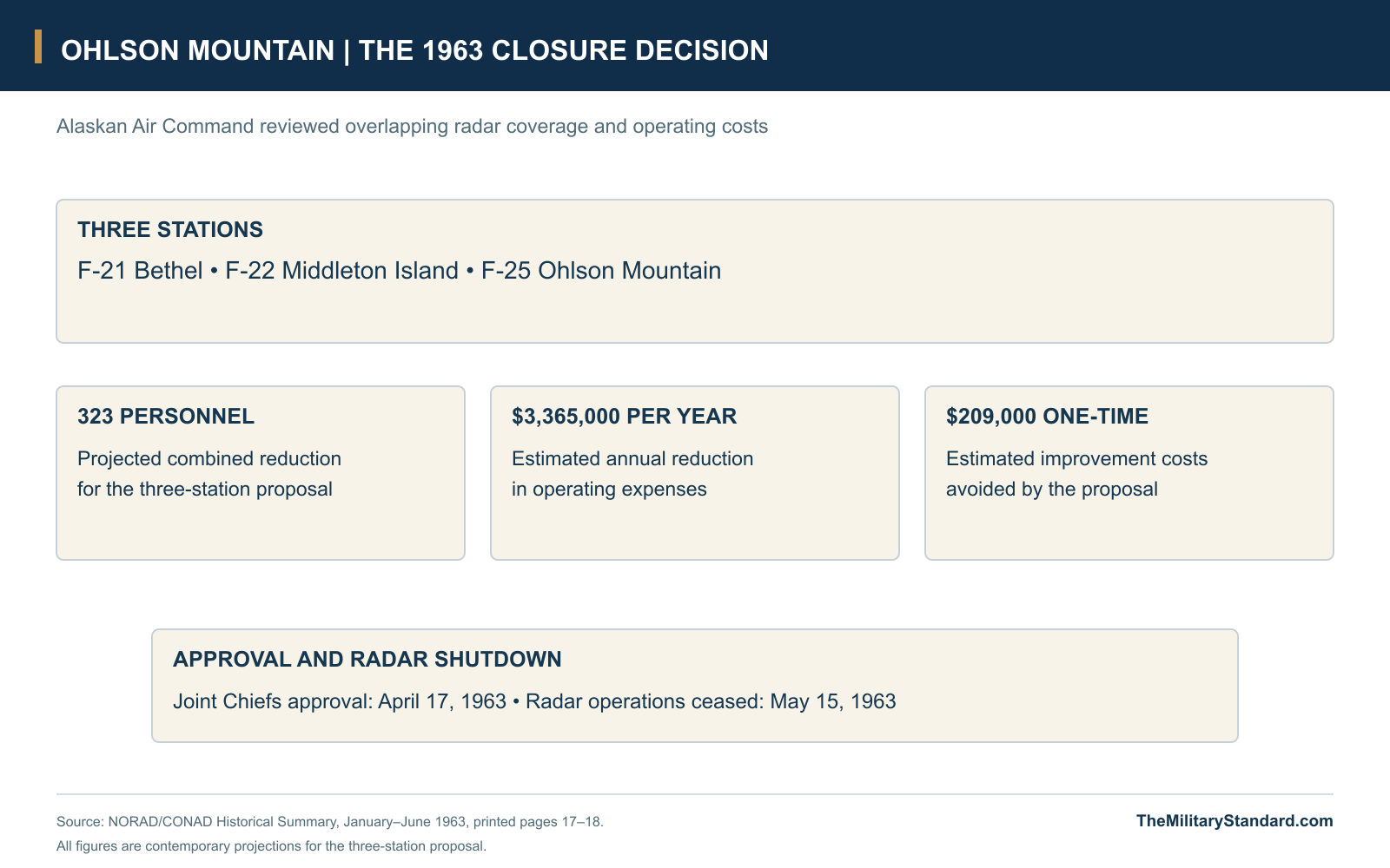
The station's end followed a review of resources and overlapping coverage across the Alaska system. NORAD's contemporary history records Alaskan Air Command's conclusion that three radars could be eliminated without serious degradation of air defense: Bethel, Middleton Island and Ohlson Mountain. The study projected a combined reduction of 323 personnel, $3,365,000 in annual operating expenses and $209,000 in one-time improvement costs. These were the estimates for the three-station proposal, reflecting a system-wide economy rather than a failure of one local radar. [4]
Alaskan Command and NORAD concurred, and the Joint Chiefs of Staff approved the inactivations on April 17, 1963. All three stations ceased operations on May 15. Ohlson Mountain's recently modernized search equipment therefore left the warning network after only a few years of service at the site. The 937th Squadron was inactivated later, in October, separating the end of the radar watch from the final organizational milestone. [1] [4]
Sale and Auroral Research
The General Services Administration sold the former station to a private firm in December 1964 for a reported $32,500. A much smaller portion, identified in the Air Force history as 3.67 acres, was then leased for defense research during 1965-1978. Stanford Research Institute conducted auroral studies, giving the hilltop a scientific use after its aircraft-control mission had ended. Studying the aurora gave the former military property a use connected to Alaska's upper atmosphere rather than to tracking aircraft. [1] [2]
The Corps places the research area off the southwest edge of the main building site and records lease dates from November 8, 1965 to December 1, 1978. Later inspection found a research van there, while the original barracks and service buildings deteriorated. This smaller research occupation did not recreate the staffed radar community that had existed under the 937th Squadron. It was another phase in the use of the property, with a different scale, purpose and set of operating requirements. [1] [2]
Clearance and the Hilltop Today
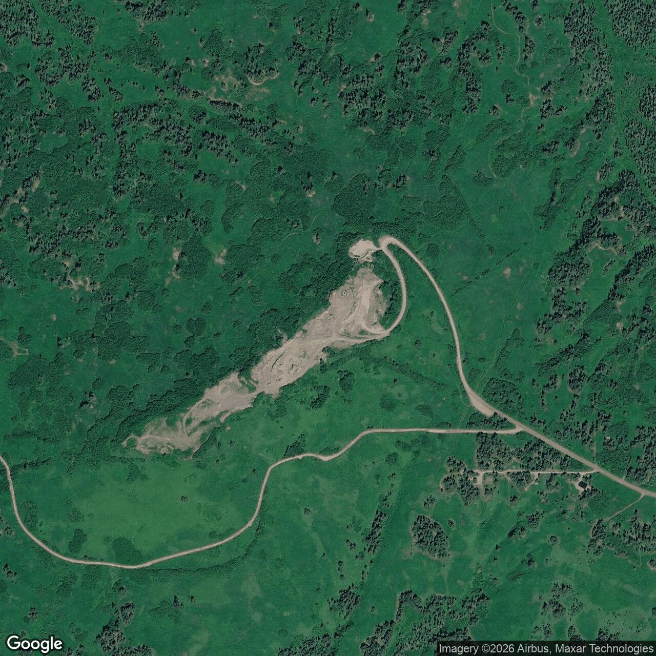
By the time of the 1985 inspection, vandalism and structural deterioration had badly affected the former military buildings. Removal of hazardous materials began that year, followed by contaminated-soil work in 1991 and state closure action in 1992. The Air Force history records remediation in 2005, by which time the substantial radar and support plant had disappeared. The sequence separates the military shutdown, later research, environmental work and physical loss of the buildings rather than treating them as one closing event. [1] [2] [8]
Later land use has continued to change the summit. In October 2026, the state published an intent to issue a material-sale contract for a designated Ohlson Mountain site, showing the ridge's continuing role as a source of construction material. That notice describes a sale area within a broader material site; the historic radar installation covered a different area and served a different purpose. The state's former-station cleanup record remains listed as Cleanup Complete, while the archival plans and photographs preserve the layout of a community no longer standing on the hill. [8] [9]
Ohlson Mountain's importance rests in both its short military career and the unusually clear record of its physical organization. Two radar positions, a connected composite, utility buildings, tanks and an access road supported a watch belonging to a much larger defense. Its closure shows how rapidly strategic priorities and judgments about redundancy could change the life of a recently built installation. The surviving photographs also preserve a more local story, in which the radar station stood above Homer's roads, homes and ski slopes during a formative period for both the military network and the surrounding community. [1] [2] [4] [5] [6]
Chronology
- Late 1954: Air Command and Corps representatives survey the Ohlson Mountain location. [1]
- June 1955: Construction begins under a contract awarded to Chris Berg of Seattle. [1]
- 1957: The 937th Aircraft Control and Warning Squadron is activated. [1]
- Early 1958: The radar station enters service near Homer. [1] [2]
- July 31, 1958: NORAD lists F-25, the 937th Squadron, FPS-3(A), FPS-6(A) and a GCI role. [3]
- 1961-1962: The station receives AN/FPS-20A search radar. [1]
- April 17, 1963: The Joint Chiefs of Staff approve closure of Ohlson Mountain, Bethel and Middleton Island. [4]
- May 15, 1963: The three stations cease radar operations. [4]
- October 1963: The 937th Squadron is inactivated. [1]
- December 1964: The GSA sells the former station to a private firm for a reported $32,500. [1]
- November 8, 1965: The later defense-research lease begins. [2]
- December 1, 1978: The research lease period recorded by the Corps ends. [2]
- 1985: Inspection finds deteriorated buildings, and hazardous-material removal is undertaken. [2] [8]
- Fall 1991: Contaminated soil is removed for treatment. [8]
- April 6, 1992: DEC records closure following the soil work and verification sampling. [8]
- 2005: The Air Force history records remediation of the former station. [1]
- June 30, 2009: DEC records concurrence with a Corps closure decision document. [8]
- October 7, 2026: DNR publishes an intent for a material sale at an Ohlson Mountain designated site. [9]
Related Sites
Information sources (11)
- PDFU.S. Air Force, History of the Aircraft Control and Warning System in Alaska: Air Defense of Arctic Skies, Argonne 2002, updated CEMML 2013
Printed pages 65-66: 70-acre station, 1954 survey, Chris Berg construction from June 1955, March 1958 operation, 937th ACWS, radar equipment, 1963 closure, 1964 sale and later research. Includes an undated Eleventh Air Force archival aerial.
- PDFU.S. Army Corps of Engineers, D. Colt Denfeld, The Cold War in Alaska: A Management Plan for Cultural Resources, August 1994
Printed pages 164-165: eleven two-story wood-frame buildings, composite-building functions and 210-man barracks capacity, water plant and tank, later research lease, 1985 condition and hazardous-material removal. The station opening is dated February 1958 in this account.
- PDFHeadquarters NORAD/CONAD, Historical Summary, January-June 1958
Original July 31, 1958 equipment appendix, PDF page 149, identifies F-25 Ohlson Mountain, the 937th Squadron, FPS-3(A) search, FPS-6(A) height finding and a GCI role.
- PDFHeadquarters NORAD/CONAD, Historical Summary, January-June 1963
Printed pages 17-18, PDF pages 30-31: review of radar redundancy, projected combined manpower and cost savings, April 17 approval and May 15 cessation at Bethel, Middleton Island and Ohlson Mountain. Original scans preserved locally.
- WEBOhlson Mountain Closure Report site plan, December 29, 1994, reproduced by the Online Air Defense Radar Museum
Original plan caption identifies Solid Waste Permit 8723-BA004. Building outlines, access road, contours, two radar towers, composite, fuel, water and storage facilities appear with structure numbers.
- WEBAlaska Lost Ski Areas Project, Ohlson Mountain Air Force Rope Tow, contributor history and photograph collection
Military and public use of the rope tow, Kachemak Ski Club races on the north and west slopes, John Jake McLay photographs and dated October 1961-March 1962 station views credited through the Radar Museum.
- WEBR. H. Moss, Kachemak Ski Club History, 1958-1996, reproduced by Alaska Lost Ski Areas Project
Firsthand community account of ski-tow relocations, Ohlson Mountain facilities and the club's development. Distinguishes the earlier road-side hills from the Air Force slope.
- WEBAlaska Department of Environmental Conservation, Ohlson Mt. DERA Site, Hazard ID 480
NAD83 environmental reference, Mile 4.5 Ohlson Mountain Road, 1985 removal, 1991 soil work, April 1992 closure and June 2009 decision. Current case status checked November 7, 2026.
- WEBAlaska Department of Natural Resources, Public Notice of Contract Issuance, ADL 234948, October 7, 2026
Notice of intent for a 5,000-cubic-yard material sale at designated site MS 430-625-1 atop Ohlson Mountain. Describes a roughly one-acre sale area within the broader designated material site.
- PDFU.S. Army Corps of Engineers, Historical Overview and Inventory of the White Alice Communications System, 1988
Diamond Ridge's separate mixed troposcatter/microwave station near Homer, with paths toward Big Mountain, Pillar Mountain and Starisky Creek. Original inventory distinguishes relay equipment from Ohlson Mountain radar.
- WEBNatural Earth, 1:10m Admin 0 Countries
Public-domain shoreline geometry for the separate Homer and Kachemak Bay location diagram. The former-station point comes from DEC source 8.