
Bethel Air Force Station, Alaska
The 713th AC&W Squadron, a short radar watch and the changing landscape of western Alaska's defense network.
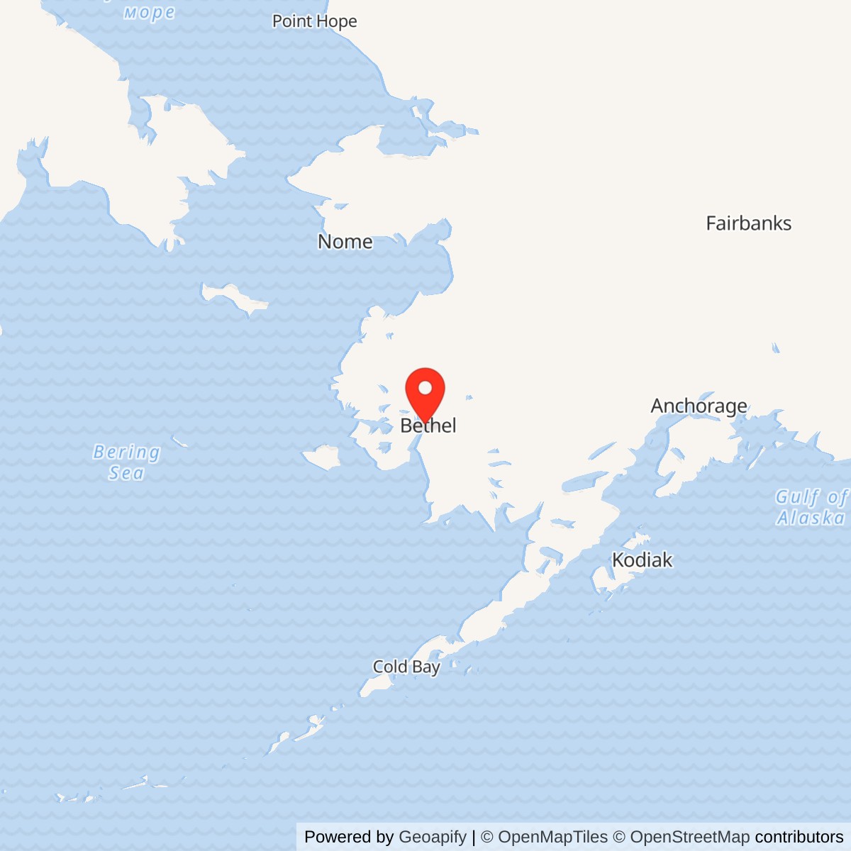
Longitude: -161.881143
Site Number: F-21
Current Role: Former AC&W/BIA headquarters landscape; DEC Hazard 2899 active in 2026. Headquarters structure and slab removed by 2024; USFWS landfarming on former building footprint in 2026 and additional soil work planned. Separate RRS parcel and military-airport property not merged.
- Station code
- F-21, Alaskan Air Command aircraft-control-and-warning system
- Operating unit
- 713th Aircraft Control and Warning Squadron
- Radar period
- Permanent station in service during 1958; radar operations ended May 15, 1963
- Original radar
- AN/FPS-4 height finder
- Modernization
- AN/FPS-20A search radar recorded in 1961
- Main facilities
- Radar towers and radomes, composite building, shops and storage
- Communications
- Associated Bethel White Alice relay; Aniak, Cape Romanzof and Cape Newenham paths
- Later use
- Former composite building adapted as BIA Bethel headquarters; later demolition and soil restoration
- Acreage
- Historical land descriptions have different scopes; radar-only property area remains unresolved
- Location
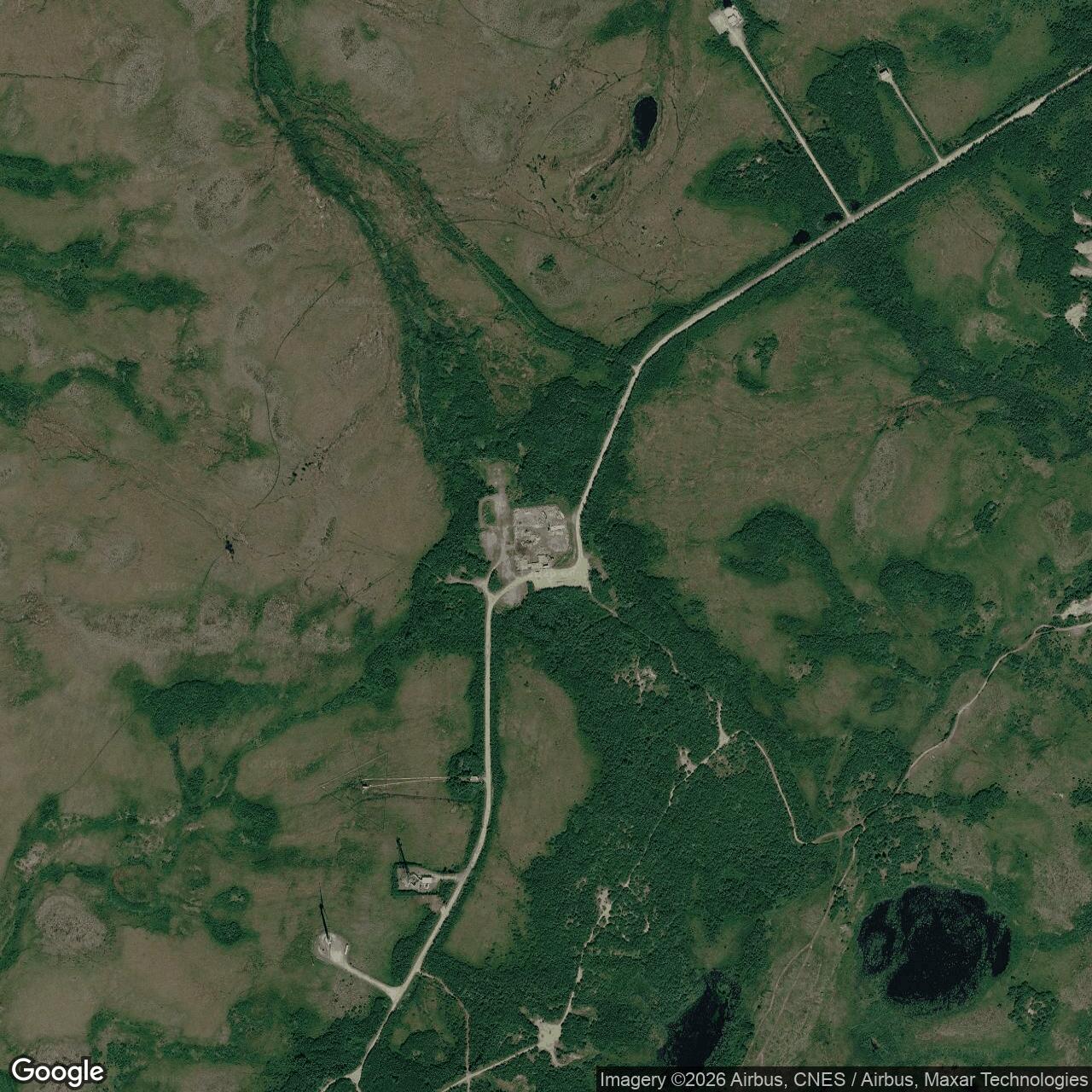
- West of Bethel, Bethel Census Area, Alaska; DEC former AC&W/BIA reference 60.785381, -161.881143
A Radar Watch West of Bethel
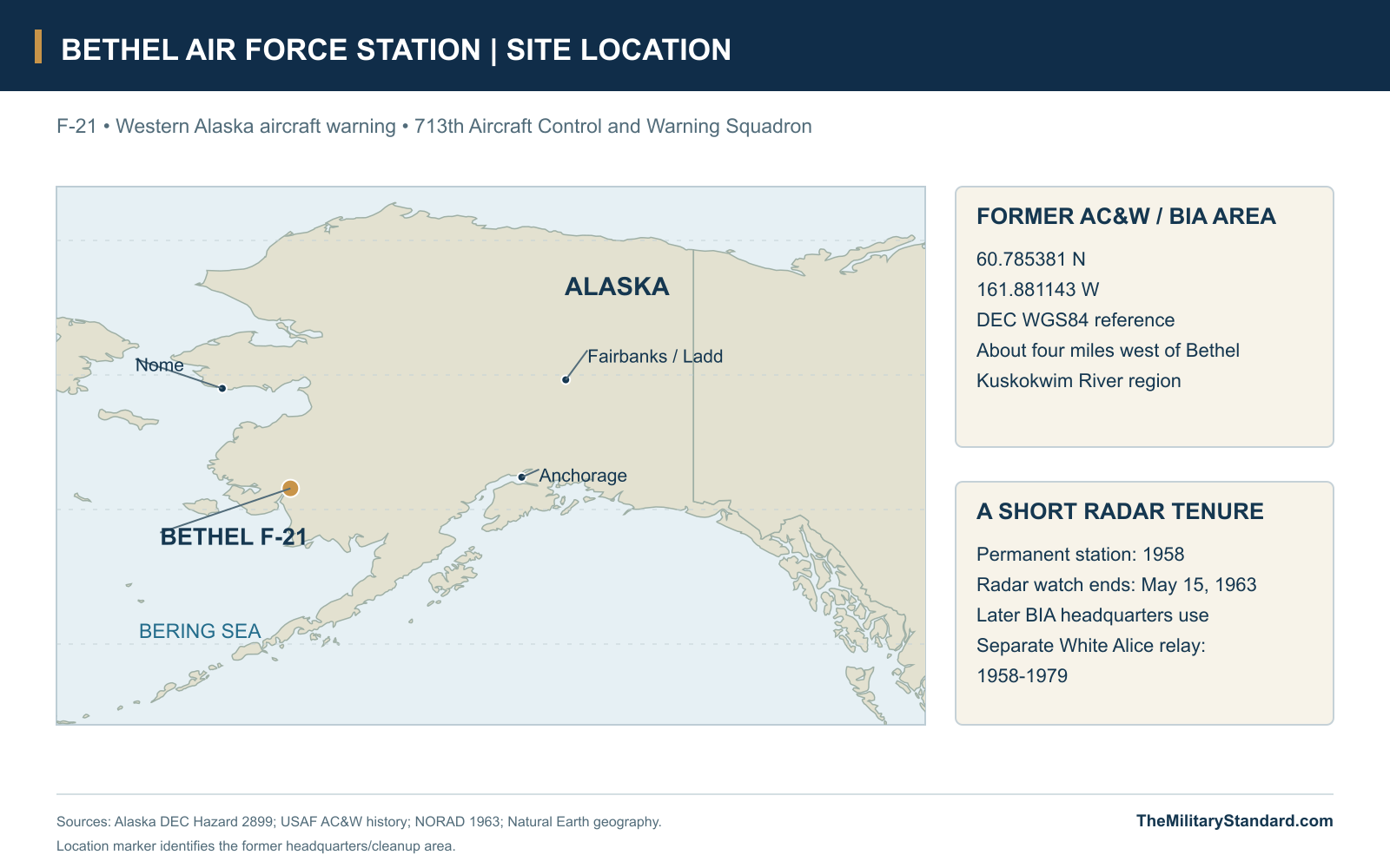
Bethel Air Force Station was a short-lived but important part of Alaska's early Cold War aircraft-warning system. Known as F-21, it was operated by the 713th Aircraft Control and Warning Squadron on low ground west of Bethel. Its radars searched the western approaches and supplied aircraft information to a regional defense organization whose fighters and command centers were elsewhere. The station entered service during the 1958 expansion of that network and stopped radar operations on May 15, 1963, when the Air Force reduced several southern surveillance positions. [1] [2] [3]
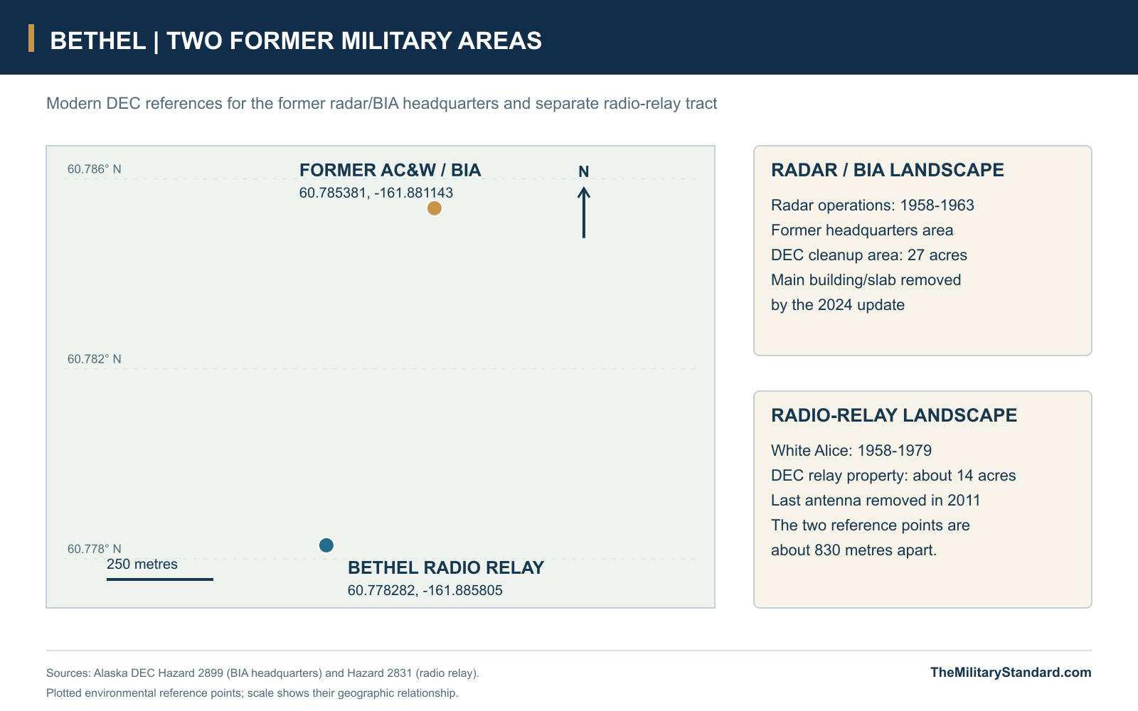
The former installation lay about four miles west of the town and the Kuskokwim River, in rolling tundra with wetlands, small streams and a pond. The Air Force's historic study describes ground about 170 feet above sea level, with sedges, moss, willow and alder around the developed area. The modern location reference is the Alaska DEC point for the former AC&W/BIA headquarters property, 60.785381 degrees north, 161.881143 degrees west. That point locates the later administrative and cleanup area associated with the radar station; it is separate from the radio-relay reference farther south. [1] [5] [6]
From Emergency Coverage to a Permanent Station
Bethel's military radar history began before the permanent F-21 installation. In the early postwar years Alaskan Air Command used an interim arrangement of older radars at selected airfields and communities while seeking money for a more durable defense system. Bethel was among those temporary locations. Limited equipment, maintenance difficulties and unreliable radio propagation constrained the early network. Its purpose was nevertheless urgent: aircraft approaching Alaska needed to be detected and reported early enough for headquarters to assess the threat and for interceptors to respond. [1] [7]
The permanent Alaska system developed in stages. Its first control and interception sites served the major approaches and operating bases, while a later construction program filled additional gaps with stations such as Kotzebue, Unalakleet, Fort Yukon, Ohlson Mountain, Middleton Island and Bethel. These positions were parts of one regional warning system rather than independent air-defense bases with their own fighter squadrons. Bethel's southwestern location extended the reporting network over an approach that earlier construction had not fully covered, making its value dependent on both the local radar horizon and communications with the rest of the system. [1] [2]
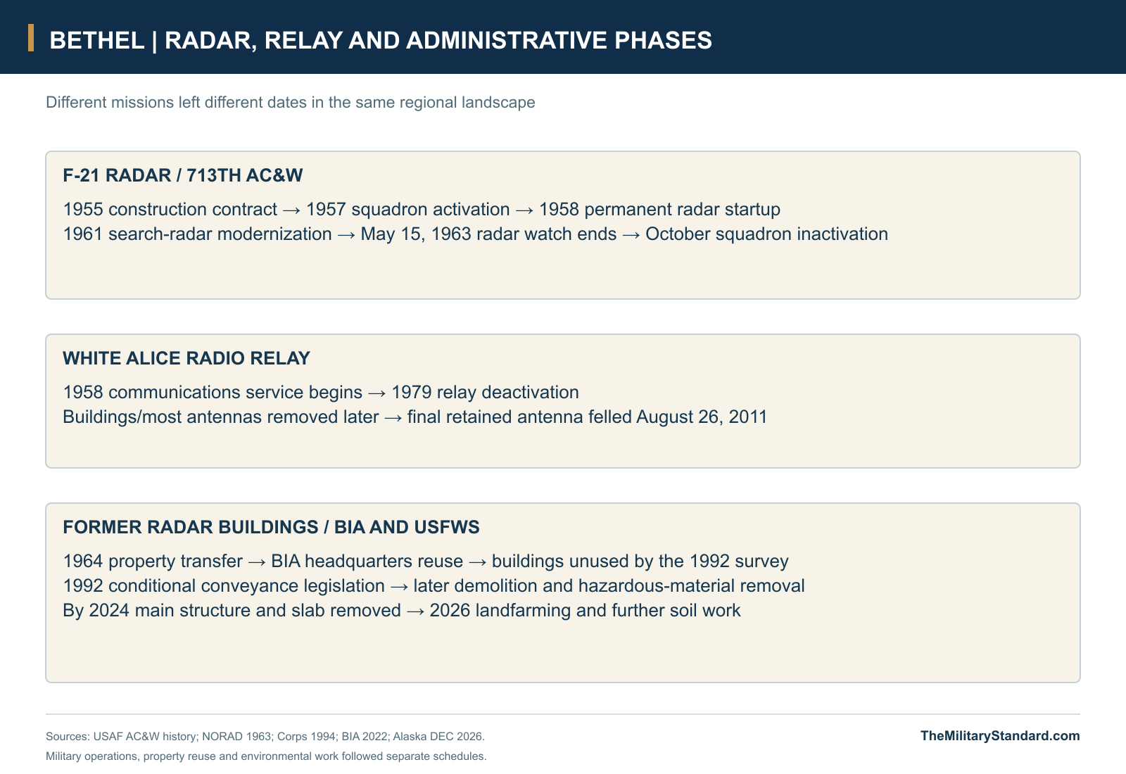
Morrison-Knudsen received the Bethel construction contract in 1955, and the new compound took shape during the expansion of Alaska's radar and communications infrastructure. The site brought together technical equipment and the buildings needed to house and sustain the operating force. A White Alice relay was also built in the Bethel area during 1957 and began service in January 1958. The two functions were closely associated, but they had different equipment and eventually different closing dates: the radar station supplied observations, while the communications installation carried information between distant stations. [1] [4] [7]
The startup of the permanent station occurred in 1958, although accounts describe different milestones. The later Air Force historic study dates local operation to June. NORAD's contemporary January-June summary still listed Bethel as the remaining addition to the Alaska network and forecast entry in August. Local readiness and acceptance into an integrated reporting network could be recorded separately. The transition is best understood as a commissioning period during 1958, when a newly built installation was becoming part of an already operating regional defense organization. [1] [2]
The Radar Compound and Its Working Buildings
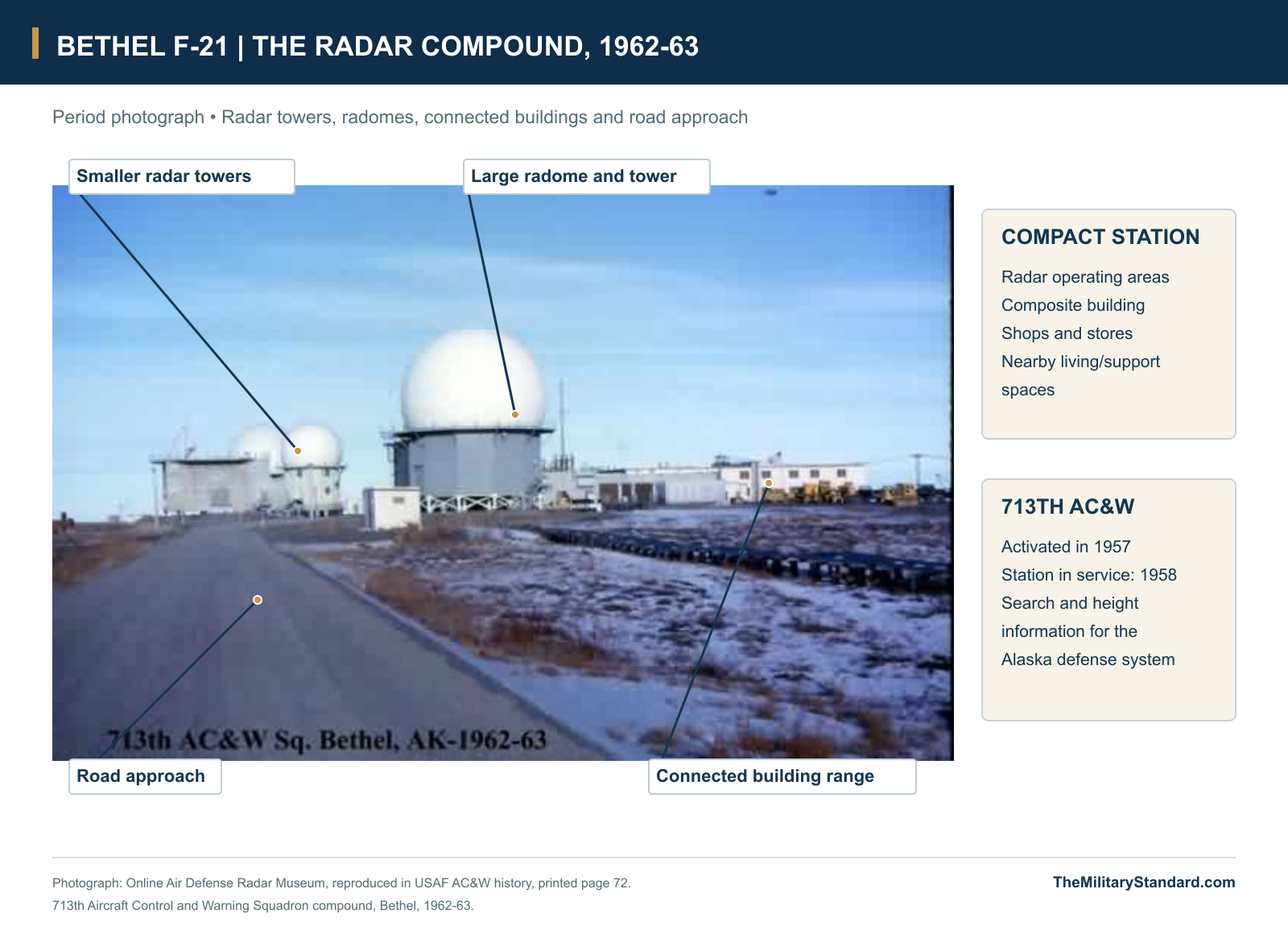
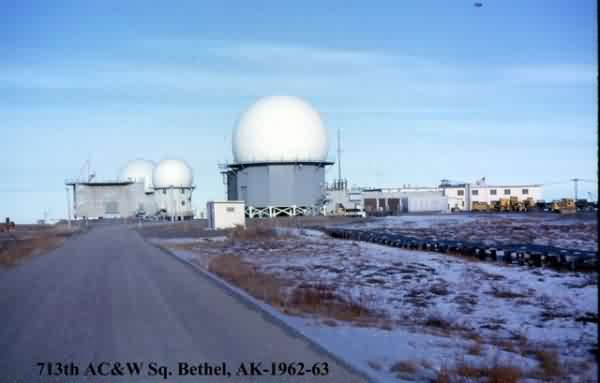
The station's physical arrangement concentrated its radar and support functions in one developed compound. Denfeld's Corps of Engineers history describes a composite building together with shop and storage buildings. The surviving 1962-63 photograph shows radar towers and radomes beside a connected range of low buildings, reached by a road across the tundra. This was a compact technical community: the radar positions required nearby electronics and operating spaces, while accommodation, maintenance, stores and utilities made a continuous watch possible away from the town center. [1] [4] [13]
The composite building was the installation's most adaptable asset. It combined enclosed space that could support station personnel and technical work in a climate where movement, heating and dependable services affected daily operations. Separate shop and storage facilities supported equipment repair and supplies. Their usefulness outlasted the radar mission; after closure, the Bureau of Indian Affairs reused the principal building as its Bethel headquarters. The transition from radar compound to civilian administrative complex explains why later photographs and records often use a BIA building number rather than the old F-21 station code. [4] [5] [9]
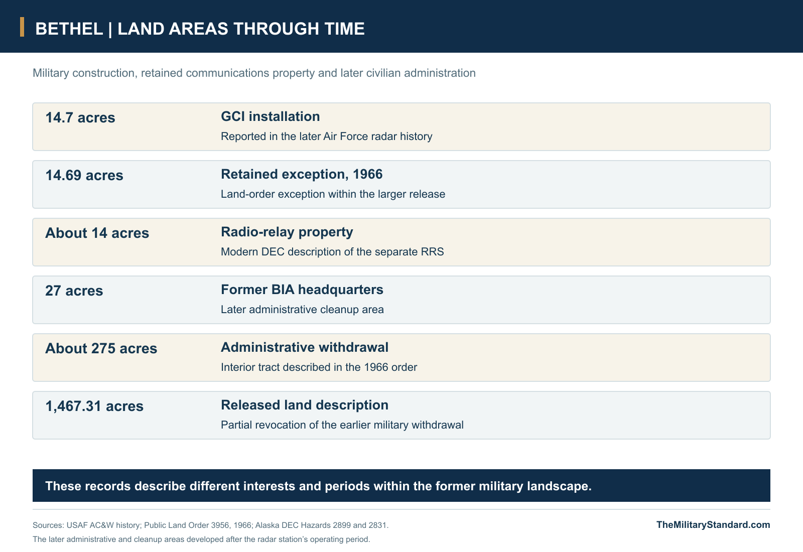
Land descriptions around Bethel changed with the installation's administrative history. The Air Force study reports a 14.7-acre GCI installation, while the 1966 land order describes a 14.69-acre exception within a much larger release and a separate administrative withdrawal of about 275 acres adjoining White Alice property. Later environmental management identifies a 27-acre former BIA area and a separate 14-acre relay tract. These figures describe different land interests and periods. The developed radar compound was part of that wider military landscape, whose later subdivision continued after F-21 ceased operating. [1] [5] [6] [8]
Search Radar, Height Finding and Aircraft Reports
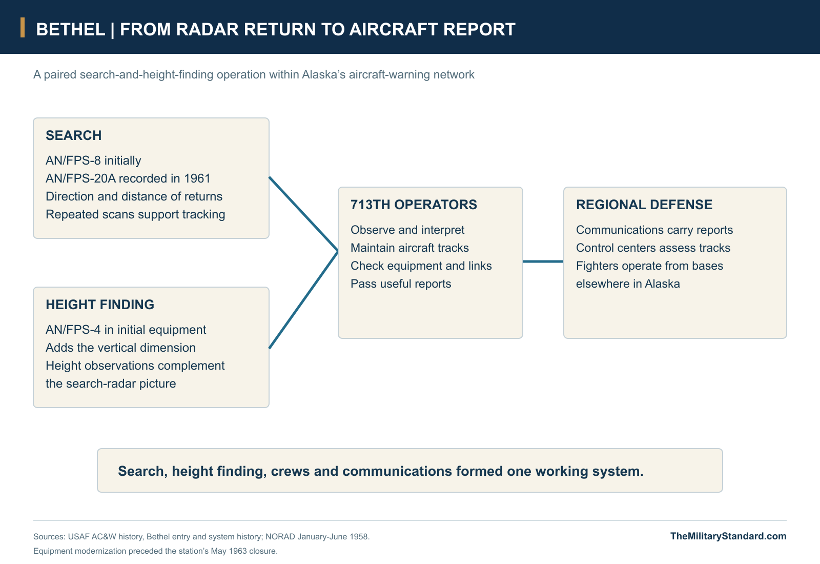
Bethel initially used an AN/FPS-4 height-finding radar. The search set supplied the broad view of aircraft activity, locating returns by direction and distance. Height finding added the vertical information needed to understand an aircraft's position and to support interception. Operators had to interpret the observations, maintain tracks and communicate useful reports. Radar coverage was therefore the product of equipment and trained crews working together, rather than the automatic consequence of erecting a tower on an exposed site. [1]
The historic equipment account records an AN/FPS-20A replacement in 1961. That change placed a newer search system at Bethel during the final part of its short operating life. It also reflected the wider pattern of upgrading an existing station while the Air Force reconsidered the overall distribution of radar coverage. The 1962-63 photograph preserves the late operational compound, with several radomes rising above the buildings. The station's technical history thus includes both an initial equipment combination and modernization before the decision to close. [1] [13]
The 713th Aircraft Control and Warning Squadron supplied the military organization that operated and maintained F-21. Alaskan Air Command activated the squadron in February 1957, before the permanent radar was ready, and the unit remained associated with the station until inactivation in October 1963. Its work combined radar operation, electronics maintenance, reporting and the ordinary support duties of a remote military establishment. The gap between squadron activation and radar commissioning reflects the need to organize people and support before a technical installation could sustain an operational watch. [1]
Communications and the Western Alaska Network
Radar information had value only if it reached the organizations able to assess it and direct a response. The Alaska warning system combined coastal and interior radar stations with control centers and fighter bases. Fire Island and Murphy Dome were early control positions, while Elmendorf and Ladd housed the principal air-defense headquarters and flying organizations. Bethel contributed observations from the southwest to that regional picture. Its history belongs to the aircraft-surveillance and interception network, rather than to the separate ballistic-missile warning mission later associated with Clear. [1] [2] [7]
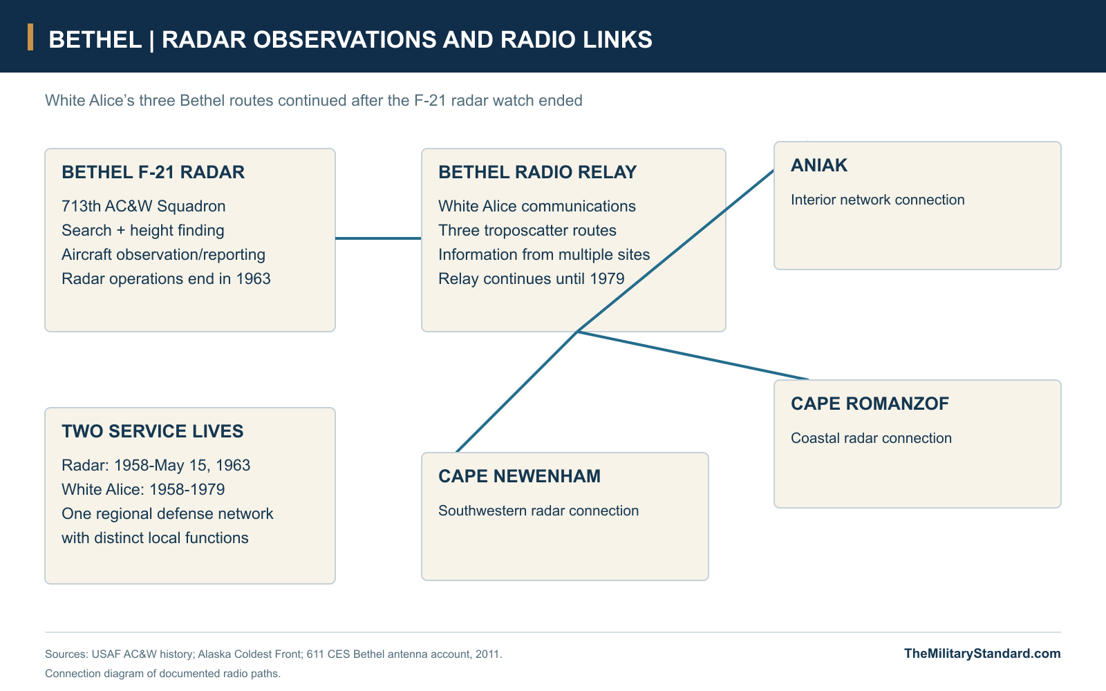
White Alice gave the Bethel area a communications role larger than the local radar mission. Three tropospheric-scatter routes connected the relay with Aniak, Cape Romanzof and Cape Newenham. Large reflectors, electronic equipment, power and fuel infrastructure sustained those paths across distances beyond ordinary line-of-sight microwave operation. The relay could carry information generated elsewhere as well as traffic associated with the nearby radar establishment. This broader network function helps explain why communications continued at Bethel long after the 713th's radar watch ended. [7] [11]
The close relationship between the two installations also shaped their support arrangements. The radar compound's accommodation and services belonged to a larger operating community, while the communications plant supplied the circuits that helped make remote radar reporting practical. After the radar shutdown, property decisions and civilian reuse altered that relationship without immediately ending every military communications function in the area. The Bethel Radio Relay Station continued until 1979, retaining its own operational chronology and leaving a different set of structures and land-management obligations. [1] [4] [6] [11]

Working Through the Cold War Watch
Bethel's operating force maintained its watch through the changes in weather, light and ground conditions that affected western Alaska. The technical equipment depended on reliable power, heat and maintenance; the personnel depended on food, accommodation, transport and communications with home and higher headquarters. The Air Force's wider AC&W remembrances describe how these support systems shaped life across the radar network. At Bethel the compact grouping of towers and buildings reduced the physical separation between the operating plant and its supporting community, while the road connection linked that community to the regional town. [1] [13]
The station's Cold War purpose was readiness rather than combat from a local runway. Its crews contributed to the continuing detection and assessment of aircraft approaching Alaska during a period of tension between the United States and the Soviet Union. That responsibility required repeated routine work: watching displays, checking communications, servicing equipment and handing a reliable picture to the next watch. Bethel's significance lies in this sustained regional air-defense contribution and in the rapid change that made a recently constructed and modernized station expendable within only a few years. [1] [2] [3]
The 1963 Economy Decision
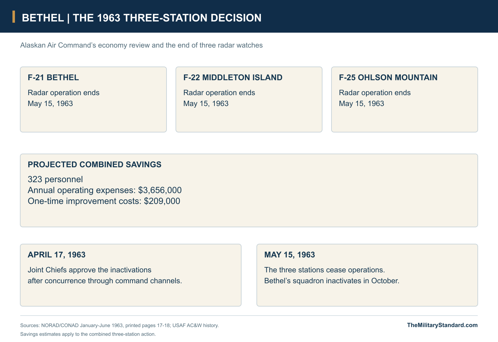
NORAD's original closure account explains the decision in terms of economy and overlapping coverage. Alaskan Air Command concluded that it could remove three radars without serious degradation of the defense system: Bethel F-21, Middleton Island F-22 and Ohlson Mountain F-25. The study projected a combined reduction of 323 personnel and annual operating savings of $3,656,000, together with $209,000 in one-time improvement costs avoided. These were estimates for the three-station action as a whole, illustrating the scale of the regional review rather than the individual cost of Bethel. [3]
The recommendation moved through command channels before the stations stopped operating. The Commander in Chief, Alaska, concurred and sent it through NORAD to the Joint Chiefs of Staff; the Joint Chiefs approved the inactivations on April 17, 1963. All three ceased operations on May 15. Bethel's radar shutdown therefore occurred within a coordinated change to Alaska's warning network. The 713th squadron's October inactivation and the later removal or transfer of equipment and buildings were subsequent administrative steps, not alternative dates for the end of the radar watch. [1] [3]
BIA Reuse and the End of the Buildings
After closure, the Bureau of Indian Affairs received permission to use the station and established its Bethel headquarters in the composite building. The General Services Administration transferred the property to BIA on October 29, 1964. Siding and interior alterations adapted the former military plant to a different workforce and purpose. Denfeld's 1992 inspection found the buildings boarded up and unused but still in good condition; the radar towers remained standing without a new function. The military construction had survived into a civilian administrative phase, although its original technical mission was gone. [4]
Later legislation tied the former BIA property to regional health needs. Section 13 of Public Law 102-497, enacted in 1992, directed a conditional conveyance of buildings and up to 27 acres to the Yukon Kuskokwim Health Corporation and assigned environmental-response responsibilities to Interior and the Air Force. Cleanup, building condition and disposal costs complicated that transition. By the time of the Fish and Wildlife Service's FY2023 construction request, the project involved removal of a seven-building, 1957-era complex and more than 70,000 square feet of federal building inventory. [5] [9] [12]
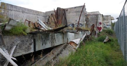
Fire damage, deterioration and hazardous building materials eventually displaced preservation or reuse of the old structures. The BIA's 2022 newsletter shows damaged remains at the former headquarters and describes cooperative abatement and disposal work. DEC subsequently reported that the full headquarters structure and its slab had been removed by 2024. The removal changed the visible landscape recorded in the station's period photograph, but it did not erase the sequence of military construction, civilian adaptation and long-term management of the ground beneath the buildings. [5] [9] [10]
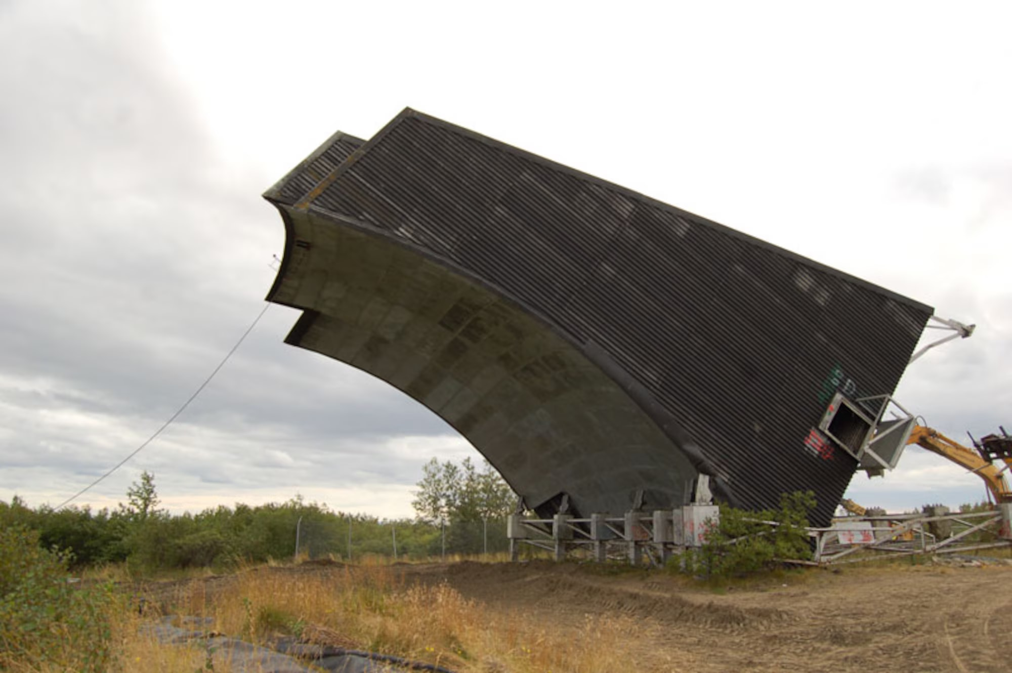
In 2026 DEC continued to list the former BIA headquarters cleanup case as active, with landfarming on the former building footprint and further contaminated soil identified for later work. The neighboring radio-relay property has its own cleanup history; the last White Alice antenna there was felled on August 26, 2011. Bethel's surviving military legacy is consequently spread across records, altered land and separate restoration areas. The short radar chapter remains distinctive: F-21 helped complete Alaska's late-1950s aircraft-warning network and then became one of the stations removed when cost and coverage priorities changed. [3] [5] [6] [11]
Chronology
- Early 1950s Bethel participates in Alaska's temporary radar coverage before the permanent F-21 station. [1]
- 1955 Morrison-Knudsen receives the permanent Bethel radar construction contract. [1]
- February 1957 Alaskan Air Command activates the 713th Aircraft Control and Warning Squadron. [1]
- 1957 Construction of the associated Bethel White Alice communications plant proceeds. [1] [11]
- January 1958 The separate White Alice relay begins operation. [1] [11]
- 1958 The permanent radar station enters service; the later Air Force study gives June, while NORAD's midyear account forecasts August network entry. [1] [2]
- 1961 The recorded search-radar modernization introduces AN/FPS-20A equipment. [1]
- 1962-63 A period photograph records the operational radar compound and its radomes. [13]
- April 17, 1963 The Joint Chiefs approve inactivation of Bethel, Middleton Island and Ohlson Mountain. [3]
- May 15, 1963 The three radar stations cease operations. [3]
- October 1963 The 713th Aircraft Control and Warning Squadron inactivates. [1]
- October 29, 1964 GSA transfers the former radar property to the Bureau of Indian Affairs. [4]
- March 22, 1966 Public Land Order 3956 publishes the changed Bethel land withdrawals and administrative tract. [8]
- 1979 Bethel's separate White Alice relay ends operation. [1] [11]
- 1992 The former radar buildings are inspected during their unused BIA period; Congress legislates a conditional health-corporation conveyance. [4] [12]
- August 26, 2011 The final White Alice antenna is felled on the separate relay property. [11]
- 2022 BIA publishes a photograph and account of headquarters demolition and abatement. [10]
- By 2024 DEC reports removal of the former headquarters structure and slab. [5]
- 2026 DEC reports landfarming and further planned soil work in the former headquarters area. [5]
Related Sites
Information sources (14)
- PDFU.S. Air Force / Alaska Office of History and Archaeology, History of the Aircraft Control and Warning System in Alaska, updated 2013
Bethel entry, printed page 72: setting, Morrison-Knudsen construction, 713th squadron, radar equipment, 1961 modernization and 1963-64 transition; system history and remembrances.
- PDFHeadquarters NORAD, Historical Summary, January-June 1958
Printed page 48 describes the Alaskan radar network and Bethel F-21 as its remaining station, then expected to join in August 1958.
- PDFHeadquarters NORAD/CONAD, Historical Summary, January-June 1963
Printed pages 17-18: review of Bethel, Middleton Island and Ohlson Mountain, projected combined savings, April 17 approval and May 15 cessation of operations.
- PDFD. Colt Denfeld, U.S. Army Corps of Engineers, The Cold War in Alaska, August 1994
Bethel composite, shop and storage buildings; May 15, 1963 closure; BIA reuse, October 29, 1964 transfer and 1992 building conditions.
- WEBAlaska Department of Environmental Conservation, Bethel BIA Headquarters, Hazard ID 2899
WGS84 former AC&W/BIA reference, 27-acre cleanup area, later federal land administration, building demolition, 2024 slab removal and 2026 restoration activity.
- WEBAlaska Department of Environmental Conservation, Bethel Radio Relay Station, Hazard ID 2831
Separate 14-acre relay tract and environmental reference, White Alice history, demolition and continuing management.
- PDFAlaska Office of History and Archaeology, The Coldest Front: Cold War Military Properties in Alaska
Regional aircraft-warning and White Alice development, network roles and the later loss of Bethel's communications structures.
- PDFU.S. Department of the Interior, Public Land Order 3956, Federal Register, March 22, 1966, pages 4792-4793
Partial revocation of the 1955 military withdrawal, 1,467.31-acre release description, separate 14.69-acre exception and approximately 275-acre administrative tract adjoining White Alice property.
- PDFU.S. Fish and Wildlife Service, FY2023 Budget Justification, Construction, page C-15
Building 413 removal project, 1957 building complex, seven-building demolition scope, environmental responsibilities and proposed health-corporation reuse.
- PDFBureau of Indian Affairs, Trust Quarterly Newsletter, Issue 4, March 2022, page 32
Bethel BIA headquarters demolition photograph and account of cooperative Interior-agency abatement and disposal work.
- WEBU.S. Air Force, 611th Civil Engineer Squadron, Cold War Era White Alice Communication System Antenna Felled for a Clean and Safe Dismantling, 2011
Bethel relay's three connections, 1979 shutdown and August 26, 2011 removal of its last antenna; photographs credited to Tommie Baker.
- PDFU.S. Department of the Interior, Public Law 102-497, October 24, 1992, section 13
Conditional conveyance of up to 27 acres at the former BIA Bethel Agency and shared Interior/Air Force environmental-response responsibilities.
- PDFOnline Air Defense Radar Museum, Bethel AC&W Site photograph, 1962-63, reproduced in the Air Force AC&W history
Period view of radar towers, radomes, connected buildings and the access road, printed page 72 of the federal study.
- WEBNatural Earth, public-domain 1:50m country and coastline data
Geographic context for the regional Alaska location diagram.