Fort Point Army Base, San Francisco California
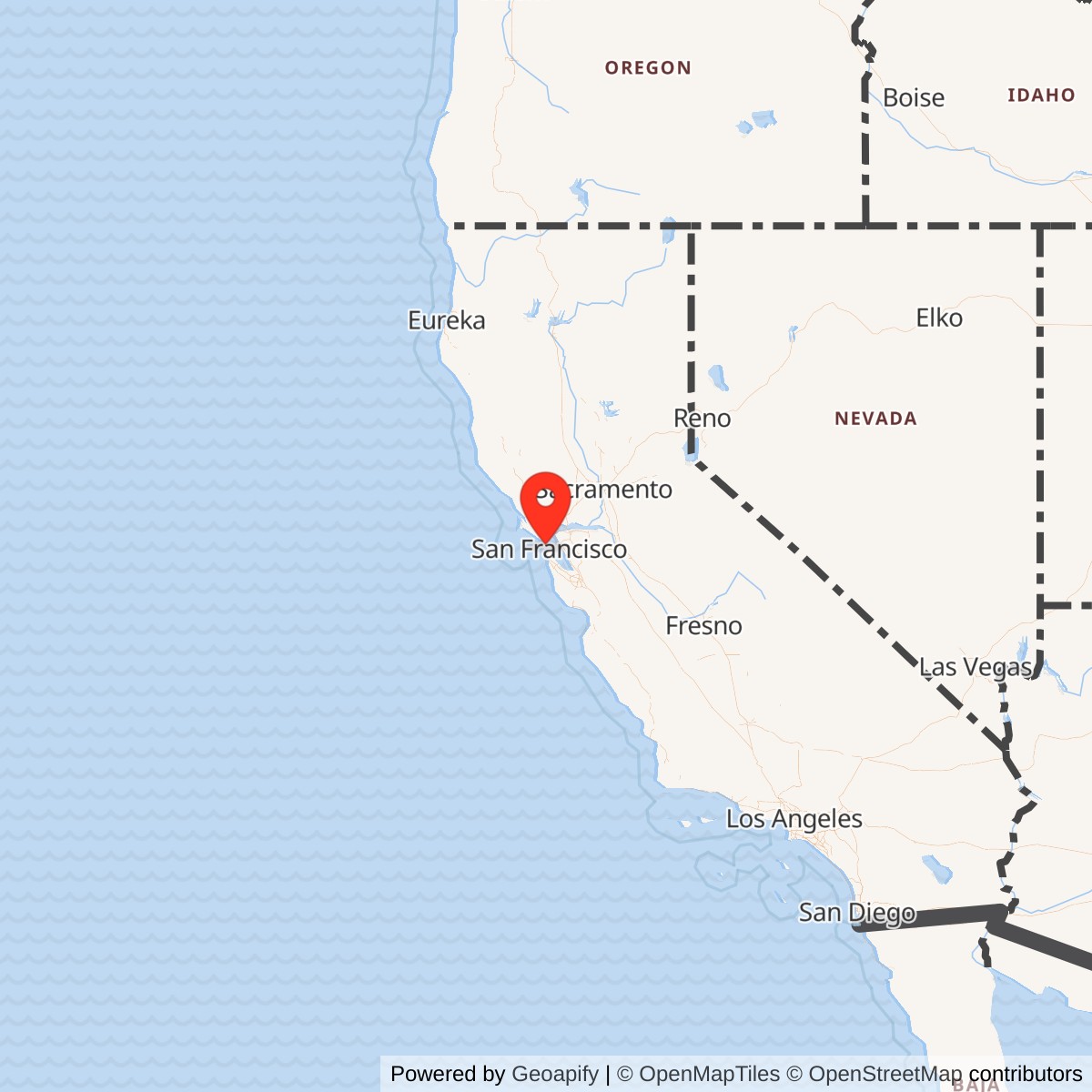
Longitude: -122.477
Official Base Website: https://www.nps.gov/fopo/
Current Role: Fort Point National Historic Site / Golden Gate National Recreation Area; public historic site and interpreted Third System masonry fort beneath the Golden Gate Bridge.
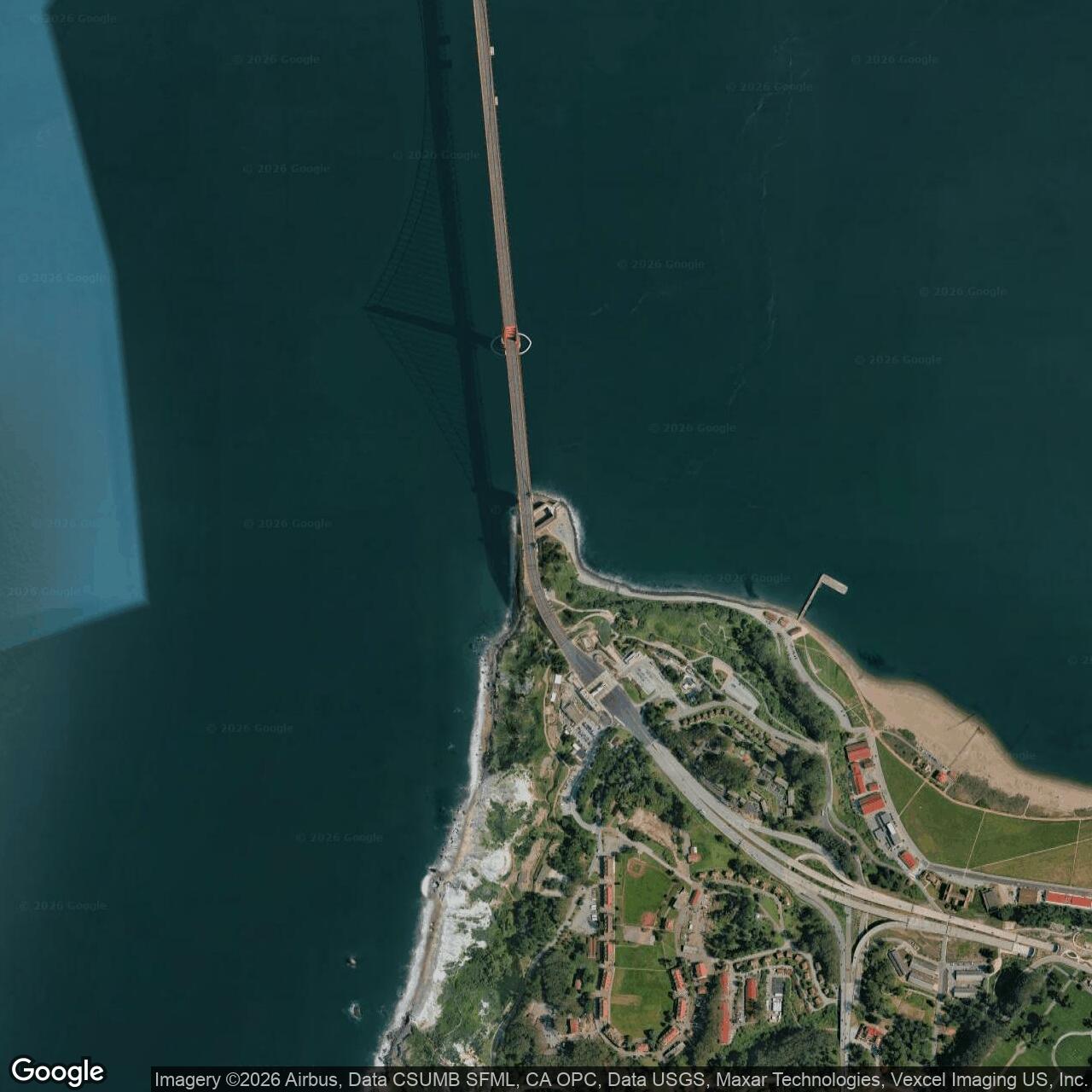
Fort Point is a closed U.S. Army seacoast fortification and current National Park Service historic site at the narrowest entrance to San Francisco Bay. The fort stands at the foot of the Presidio bluffs, directly under the southern arch of the Golden Gate Bridge, where artillery could once sweep the waterway that connected the Pacific Ocean with the bay, the city, the naval anchorage, the Army posts around the harbor, and the interior routes opened by the California Gold Rush. Its active Army combat-fort mission became obsolete in the late nineteenth century; the building was used intermittently afterward by the Presidio and was reoccupied for harbor-defense duties during World War II. It became Fort Point National Historic Site on October 16, 1970, and is now administered as part of Golden Gate National Recreation Area.
The fort's importance begins with geography. The Golden Gate is not simply a scenic strait; it is the controlling maritime entrance to San Francisco Bay. Any hostile naval force that wanted to threaten San Francisco, the Presidio, Alcatraz, Mare Island, Angel Island, Fort Mason, the later San Francisco Port of Embarkation, or the wider Pacific Coast supply system had to pass this constricted waterway. Fort Point was placed where cannon fire could reach ships at water level, where the cliffs could be cut down to put guns near the surface of the channel, and where the Army could tie the southern side of the entrance into a wider bay-defense system. That site selection made Fort Point one of the most ambitious coastal-defense works ever built in the West.
Fort Point also has a layered identity. Before the U.S. Army fort, the Spanish built Castillo de San Joaquin on the same general promontory in 1794 to protect the colonial anchorage and presidio. The U.S. Army then demolished the old high-bluff position and blasted the cliff down so the new fort's lower tier could fire at the waterline of enemy ships. The masonry fort built between 1853 and 1861 was part of the American Third System of coastal defense, the nationwide program of permanent masonry forts developed after the War of 1812. Fort Point was the only major Third System fortification built west of the Mississippi River. That fact alone shows how seriously the U.S. government viewed San Francisco after the Gold Rush.
The name history can be confusing. The masonry structure was originally known as the "Fort at Fort Point." In 1882 the Army officially named it Fort Winfield Scott, but the name did not remain attached to the old brick fort. When the newer coast-artillery post in the Presidio uplands later became Fort Winfield Scott, the older structure again became known primarily as Fort Point. This history matters because Fort Point is related to, but distinct from, Fort Winfield Scott. Fort Winfield Scott was the later coast-artillery headquarters and Endicott-era post. Fort Point was the Civil War-era masonry fortification at the water's edge, later reused by that broader Presidio and harbor-defense system.
Mission Evolution
Fort Point's mission evolved from imperial outpost to American masonry fort, from Civil War defense post to obsolete Army structure, from storage and training space to World War II anti-submarine support position, and finally into a preserved national historic site. The earliest military purpose of the location was Spanish. Castillo de San Joaquin guarded the entrance to the bay from the cliff above the water, but the adobe fort deteriorated after Mexican independence and was empty when U.S. forces occupied the site during the Mexican War era. By the time the United States gained California and the Gold Rush transformed San Francisco into the major Pacific port, the old Spanish work no longer fit the strategic situation.
The U.S. mission was far larger. Army and Navy officials in 1850 recommended a series of fortifications to protect San Francisco Bay. The intended system included Fort Point on the south side of the Golden Gate, Alcatraz in the bay, and a planned but never completed Lime Point fortification on the Marin side. Fort Point's role was to deny entry to an enemy fleet and protect the commercial and military value concentrated around San Francisco. Construction began in 1853, continued for eight years, and was still being pushed to completion as the Civil War began. The original strategic concern included possible British naval power in the Pacific, but by 1861 the more immediate worry was Confederate attack, Confederate privateering, or seizure by Confederate sympathizers in California.
During the Civil War the fort's mission became armed deterrence. It never fired on an enemy, but it mattered because it was garrisoned, armed, and visible at the bay's most critical maritime gate. Artillerymen drilled, manned batteries, guarded the entrance, maintained the guns, and lived inside the casemates. Their presence told any raider, foreign warship, or local insurgent that San Francisco Bay was not undefended. The Confederate commerce raider CSS Shenandoah later planned to attack San Francisco, but the plan ended when its captain learned the war had already ended. Fort Point's wartime importance therefore lay in prevention rather than combat.
After the Civil War, Fort Point's mission declined rapidly. The same war that made the fort urgent also proved that masonry forts could be shattered by rifled artillery. Fort Sumter and Fort Pulaski showed that brick walls designed for smoothbore-era warfare were dangerously vulnerable. Fort Point remained useful as a structure and reservation, but it lost its role as the dominant guardian of the Golden Gate. Some guns were moved to Battery East on the bluffs, where artillery could be better protected, and later Endicott-era concrete batteries on the Presidio heights and at other posts replaced the old brick fort in the harbor-defense system. By 1886, HABS documentation described Fort Point as abandoned as a fortification because more powerful rifled cannon had made the brick fort obsolete.
The Army never simply forgot the building. In the early twentieth century Fort Point was remodeled for a proposed detention-barracks function connected to the Army's military-prison system, although prisoners were never ultimately housed there in the planned way. It then served a variety of Presidio support purposes. During the 1920s it was used for unmarried officers' housing and military trade schools. It was also affected by the 1906 earthquake and later repairs, by lighthouse and maritime functions nearby, and by the construction of the Golden Gate Bridge. In the 1930s the fort became a bridge-construction support center rather than a gun fort, with its casemates and parade used for storage, offices, cafeteria space, and construction-related activity.
World War II gave Fort Point its last direct Army defensive mission. After Pearl Harbor, San Francisco Bay became a high-priority Pacific Coast defense area. The threat was no longer a sailing or steam fleet exchanging fire with masonry casemates, but submarines, fast surface craft, sabotage, and possible attack against the harbor entrance. In 1942 a steel anti-submarine net was strung across the Golden Gate from the Marin side toward the Marina Green, backed by minefields and rapid-fire guns. Fort Point received Battery Point, a small rapid-fire 3-inch anti-motor-torpedo-boat battery mounted on the barbette tier, along with a searchlight and related garrison facilities. Soldiers from Battery N, 6th U.S. Coast Artillery manned the position. By late 1944, the direct threat had receded, and in 1945 the troops departed.
The preservation mission then took over. The fort had survived because it was too useful, too massive, too picturesque, and eventually too beloved to be destroyed. Preservation advocacy began before the bridge, revived after World War II, and culminated in the creation of Fort Point National Historic Site in 1970. That mission preserved the structure as a rare Third System fort, a Civil War military site, a World War II reuse site, a lighthouse and maritime landscape, and an architectural survivor under one of the nation's most famous bridges.
Operational Role
Fort Point's operational role during its peak years was to convert a geographic choke point into a prepared artillery kill zone. The Army Corps of Engineers designed the fort so that the lowest tier of cannon would stand as close as possible to the water. At the time, smoothbore artillery fired solid shot that could skip or ricochet across the surface, striking the waterline of wooden ships. To achieve that geometry, the Army blasted a roughly ninety-foot cliff down to a much lower platform and placed the fort at the edge of the channel. The fort was not merely "near" the harbor entrance; it was engineered into the shoreline so its guns could exploit the physics of nineteenth-century naval artillery.
The planned armament was enormous. The fort was designed to mount 141 cannon in interior and exterior positions, but it never reached that full planned strength. By October 1861, there were sixty-nine guns in and around the fort, and later accounts record more than one hundred guns at Fort Point's greatest armament level. These weapons included 24-, 32-, and 42-pounder smoothbores, 8- and 10-inch Columbiads, later 10-inch Rodman guns, and other artillery associated with mid-nineteenth-century coastal defense. The fort also had hot-shot furnaces so iron balls could be heated and fired at wooden ships in an attempt to set them ablaze. Its firepower, if fully effective, would have made the entrance to San Francisco Bay extremely dangerous to an attacking wooden fleet.
The garrison's work was repetitive and disciplined. During the Civil War, soldiers stood guard, drilled with artillery, maintained powder and shot, practiced loading and firing, carried out inspections, performed sentry duty, and kept the fort habitable in a cold, damp, windswept location. Enlisted men occupied crowded casemates, and officers lived in comparatively better quarters. Fort Point was never tested by enemy bombardment, but the absence of combat did not make the work symbolic. Deterrence required readiness. The soldiers had to maintain a fort that could fight at any hour against a threat that might never appear.
Fort Point also operated as part of a larger defensive system. It was linked conceptually to Alcatraz, the Presidio, later Fort Mason / Point San Jose, Lime Point plans, Angel Island, and the evolving batteries along both sides of the Golden Gate. Its guns alone could not defend all of San Francisco Bay, but they anchored the southern side of the entrance and helped create layered fire. When newer batteries were built on the bluffs, Fort Point's relative importance declined, but its site still remained part of the defensive geography of the Golden Gate.
After obsolescence, the building's operational role became adaptive reuse. The Army used it intermittently as barracks, quarters, shop space, training space, storage, and support. HABS and NPS documentation record that Fort Point held a machine and welding shop after its closure as a fortification, that it was remodeled for a detention-barracks plan, and that during the bridge-construction years it served as a construction base. This history is important because it prevents Fort Point from being frozen as a purely Civil War monument. For the Army and later bridge builders, the massive brick building was also a convenient enclosed structure at the water's edge.
World War II gave the old fort a final tactical use. The anti-submarine net across the Golden Gate had to be protected, not just installed. Enemy vessels or fast craft might try to interfere with the net, approach the minefields, or exploit darkness and weather. Battery Point's rapid-fire guns, the searchlight, range-finding functions, and garrison spaces turned the old Third System fort into a small component of a twentieth-century harbor-defense network. The brick casemates became mess, recreation, barber, post exchange, office, and storage spaces. The fort was no longer the main battery, but it still had a practical role in keeping hostile submarines or surface craft away from the harbor entrance.
Site Design and Facilities
Fort Point is one of the clearest surviving examples of Third System military architecture in the United States. The fort has three tiers of arched casemates arranged around an interior courtyard, with a barbette tier on the roof. Its walls are roughly seven feet thick in places, and its principal materials are brick, granite, and related masonry. The structure's shape, tiers, gun rooms, embrasures, spiral staircases, parade, sally port, powder magazine spaces, and roof battery all reflect a design tradition perfected on the Atlantic and Gulf coasts but almost never built in the West.
The site preparation was as important as the building. The Army removed the high cliff and the older Spanish fort position so the new fort could fire close to the waterline. That decision sacrificed the high-ground logic of the Spanish Castillo for the low-angle artillery logic of the U.S. Third System. The result was a fort squeezed between the water and the bluff, exposed to surf, tide, fog, salt air, wind, and later bridge construction. The great seawall became essential to the fort's survival because erosion and wave action threatened the foundation almost as soon as the work was complete.
The interior was both a weapons platform and a living environment. Casemates housed guns, but also men. The same arched rooms that gave protection to cannon also became quarters, storage, mess, and work areas. The third tier housed enlisted men in crowded conditions during the Civil War, while officers had rooms on the level below. Staircases connected the tiers, and the sally port controlled entrance. The fort was defensive architecture at the scale of daily human habitation.
The roof tier gave Fort Point additional visibility and function. The barbette was designed for guns firing over the parapet, with sod cover intended to absorb impacts. A lighthouse was added in the 1860s, giving the fort a maritime-navigation role as well as a military one. The lighthouse and nearby Fort Point Station connected the Army fort landscape to the navigation and lifesaving systems that operated along the hazardous entrance to the bay. The Golden Gate was not merely defended; it had to be marked, watched, crossed, and rescued from.
Bridge construction changed the physical context without destroying the main fort. Early Golden Gate Bridge plans threatened the fort, and some outworks, including the counterscarp gallery and the ten-gun battery, were removed or damaged to make room for bridge approaches and anchorage work. The main casemated fort survived because bridge engineer Joseph Strauss and others recognized its architectural value. The bridge's southern arch now frames the fort, making Fort Point one of the rare military structures whose preservation was physically integrated into a major transportation landmark. The bridge transformed the fort's setting from an isolated harbor-defense work into a nationally recognizable architectural juxtaposition.
World War II altered the fort again. The AMTB gun platforms and searchlight installation on the barbette tier, the rehabilitation of barracks and officer spaces, and the conversion of some casemate rooms into support facilities added a twentieth-century layer to the nineteenth-century structure. These changes were practical rather than decorative. They allowed soldiers to live and work inside the building while defending the anti-submarine net and minefields. After the war, those additions became part of the fort's preservation problem: the structure had to be interpreted as a Civil War-era fort while acknowledging later military changes.
Units, Organizations, and Systems
Fort Point's early U.S. Army history belongs to the Corps of Engineers, the Department of the Pacific, the Coast Artillery's predecessors, and the broader San Francisco harbor-defense system. Army engineers selected the site, designed the fort, cut down the cliff, supervised construction, and made the fort part of the national Third System program. The construction labor force included large numbers of civilian workers, many of them miners or laborers drawn by the boom conditions of Gold Rush California. This was a military work built by a mixed world of Army engineers, contractors, craftsmen, and laborers.
During the Civil War the garrison included soldiers from the 3rd U.S. Artillery, the 9th U.S. Infantry, and the 8th California Volunteer Infantry. These units did not fight a battle at Fort Point, but they performed a strategic duty: holding a Union fort on the Pacific Coast at a time when California's gold, port, shipping, and politics mattered to the national war effort. The Confederate threat to San Francisco was never realized, but the garrison's role was part of a nationwide effort to hold key harbors, depots, and lines of communication.
Fort Point also interacted with the changing Army prison system. In the early twentieth century, the Army considered converting the fort into a detention barracks connected to the Pacific Branch of the U.S. Military Prisons. Plans and repairs went forward, and work crews altered parts of the interior, but the fort did not become the prisoner facility that planners had envisioned. This episode linked Fort Point to Alcatraz, which already had a military-prison identity before becoming a federal penitentiary. It also explains some of the structural changes made before World War I.
The Coast Artillery system eventually left Fort Point behind as a primary battery but did not sever the connection completely. Newer batteries at the Presidio, Fort Winfield Scott, Fort Miley, Fort Baker, Fort Barry, Fort Cronkhite, and elsewhere formed the modern Harbor Defenses of San Francisco. Fort Point became subordinate to that wider system. It was no longer the main gun line, but it remained at the center of the same maritime geography. During World War II, Battery N, 6th U.S. Coast Artillery operated the rapid-fire guns at Fort Point as part of the anti-submarine and minefield protection network.
The National Park Service and preservation organizations became the later institutional stewards. The Fort Point Museum Association, formed in the preservation era, advocated for the fort's protection. National historic site designation in 1970 formalized that transition. Since 1972 Fort Point has functioned within the larger Golden Gate National Recreation Area, while its location within the Presidio landscape ties it to the Presidio Trust, NPS interpretation, Golden Gate Bridge history, and the surrounding parklands.
World War II Service
Fort Point's World War II service deserves separate treatment because it was the last moment when the old fort again performed a direct defense mission. After December 7, 1941, San Francisco Bay became one of the most important West Coast military zones. The bay contained Army posts, naval facilities, shipyards, embarkation functions, supply depots, and critical transport routes. A Japanese submarine attack or infiltration attempt through the Golden Gate would have had enormous military and psychological consequences, even if the probability of a major invasion was low.
The defense response combined Army and Navy systems. A steel anti-submarine net was stretched across the Golden Gate in early 1942 from the Marin side toward the San Francisco waterfront. The net could be opened for friendly shipping and closed afterward. It was supported by minefields in the approaches to the harbor and by rapid-fire batteries guarding those minefields and the net. This was a layered harbor-defense system: obstruction, controlled access, mines, searchlights, rapid-fire guns, observation, and larger coast-artillery weapons all contributed to deterrence.
Fort Point's position made it useful again. The Army placed a pair of rapid-firing 3-inch guns on the barbette tier and named the position Battery Point. These guns were not intended to duel with battleships. They were meant to protect the anti-submarine net and minefields against smaller, faster, closer threats. A searchlight and related power equipment improved night defense. Soldiers from Battery N, 6th U.S. Coast Artillery occupied the fort and operated the equipment. The garrison lived and worked in the same structure that had housed Civil War artillerymen, but their mission reflected a different century of warfare.
The interior was refurbished for wartime support. Casemate rooms became mess, recreation, barber, post exchange, and office spaces. Gorge rooms were rehabilitated as quarters and storage areas. Some rooms stored camouflage materials used to conceal nearby gun emplacements. This reuse shows the practical value of the fort's mass and enclosed spaces even after its original weapons system had become obsolete.
The World War II period was short but historically important. It gave Fort Point a direct role in the Pacific War home-front defense of San Francisco Bay. It also preserved the continuity of Army use from Civil War deterrence to twentieth-century anti-submarine defense. When the Japanese attack threat diminished and the war moved decisively across the Pacific, troops departed in 1945. The fort then returned to a boarded-up, abandoned, preservation-threatened state until public and institutional interest grew strong enough to save it.
Closure, Transfer, and Current Status
Fort Point's closure history is layered rather than simple. As a masonry combat fortification, it was effectively obsolete soon after the Civil War and was described by HABS as abandoned in 1886 when rifled artillery made brick forts obsolete. As an Army building within the Presidio, it remained useful for other purposes into the twentieth century. As a World War II harbor-defense position, it was reoccupied from 1942 until the garrison left in 1945. As a federal historic property, it became Fort Point National Historic Site on October 16, 1970, and has been managed within Golden Gate National Recreation Area since the early 1970s.
Today Fort Point is a public historic site, architectural landmark, and interpreted military landscape beneath the Golden Gate Bridge. Visitors encounter cannon, casemates, the courtyard, the sally port, the lighthouse story, bridge views, Civil War interpretation, and the preserved structure itself. The fort is not an active Army installation. It is a National Park Service site that preserves the military, architectural, maritime, and preservation history of the Golden Gate.
The surrounding landscape also includes the U.S. Coast Guard Fort Point Station Historic District, Crissy Field, the Presidio, and the Golden Gate Bridge. Those neighboring landscapes are distinct, but they help explain the fort's present setting. Fort Point now operates less as an isolated museum than as a key stop in a larger Presidio and Golden Gate narrative: Spanish colonial defense, U.S. Army expansion, Civil War mobilization, lighthouse and lifesaving work, bridge engineering, World War II harbor defense, and post-Army public reuse.
Chronology
- 1794 Spain built Castillo de San Joaquin on the high bluff at the Golden Gate, near the later Fort Point site.
- 1821 Mexican independence ended Spanish control of California, and the old Castillo gradually declined.
- 1835 The Mexican army moved to Sonoma, leaving Castillo de San Joaquin to deteriorate.
- 1846-07-01 U.S. forces under John C. Fremont and Kit Carson occupied the empty Castillo and spiked its cannons.
- 1848 The United States acquired California after the Mexican War.
- 1849 The Gold Rush made San Francisco the major West Coast harbor and sharply increased the military importance of the bay.
- 1850 Army and Navy officials recommended a system of fortifications to secure San Francisco Bay.
- 1853 U.S. Army Engineers began construction of Fort Point.
- 1854 Inspector General Joseph K. Mansfield described the site as the key point for Pacific Coast defense.
- 1855 A temporary wooden lighthouse was built near the fort's seawall.
- 1861 Construction of Fort Point was essentially completed as the Civil War began.
- 1861 The Army mounted the first guns at Fort Point and placed troops in the fort to prevent seizure or attack.
- 1861-10 Fort Point had sixty-nine guns in and around the fort.
- 1861-1865 Fort Point was garrisoned through the Civil War by Regular Army and California Volunteer troops, but it never fired in combat.
- 1864 A hexagonal lighthouse was erected on the fort's barbette tier.
- 1865 The Confederate raider CSS Shenandoah considered an attack on San Francisco but learned the war had ended before reaching the target.
- 1869 The granite seawall protecting Fort Point was completed after years of erosion concerns.
- 1870 Some of the fort's guns were moved to Battery East on the bluffs.
- 1882 Fort Point was officially named Fort Winfield Scott.
- 1886 The Fort Winfield Scott name reverted away from the old masonry fort as new Presidio defenses developed, and Fort Point's brick-fort combat role was effectively abandoned.
- 1892 The Army began constructing modern Endicott System concrete defenses around the harbor, further displacing Fort Point's original mission.
- 1906 The San Francisco earthquake damaged the fort, and later repairs contributed to twentieth-century alterations.
- 1913 The Army decided to convert Fort Point for detention-barracks use.
- 1914 War Department orders authorized occupation of old Fort Point by the Pacific Branch military-prison command, although the planned prison use did not fully materialize.
- 1915 Fort Point was substantially rehabilitated during detention-barracks conversion work and lighthouse-related use continued.
- 1920s The Presidio used Fort Point for unmarried officers' housing and military trade schools.
- 1926 The American Institute of Architects urged preservation of Fort Point for its architectural value.
- 1933 Construction of the Golden Gate Bridge began, using Fort Point as a construction support area while threatening some of the fort's outworks.
- 1934 The Fort Point lighthouse was extinguished because Golden Gate Bridge construction blocked its function.
- 1937-05 The Golden Gate Bridge was dedicated, with the old fort preserved beneath the south approach arch.
- 1941-12-07 The attack on Pearl Harbor made San Francisco Bay a major Pacific Coast defense priority.
- 1942 A steel anti-submarine net was strung across the Golden Gate.
- 1942 Troops occupied Fort Point for World War II harbor-defense duty.
- 1942 Two rapid-firing 3-inch guns from Battery Yates at Fort Baker were mounted on Fort Point's barbette tier as Battery Point.
- 1942 Battery N, 6th U.S. Coast Artillery manned Battery Point and helped protect the anti-submarine net and minefields.
- 1945 The Japanese attack threat had receded, and the World War II garrison departed Fort Point.
- 1947 The Army held an open house at Fort Point marking a century of U.S. military presence on the site, and preservation proposals revived.
- 1959 Retired military officers and civilian engineers formed the Fort Point Museum Association to advocate for preservation.
- 1970-10-16 Fort Point became Fort Point National Historic Site.
- 1972 Fort Point came under the broader management framework of Golden Gate National Recreation Area.
- 1994 The Presidio of San Francisco transferred from the Army to National Park Service stewardship, reinforcing Fort Point's status within a larger preserved military landscape.
- Present Fort Point remains a National Park Service historic site beneath the Golden Gate Bridge, interpreting Third System coastal defense, Civil War garrison life, World War II harbor defense, bridge construction, and preservation.